+91 9051055011 | +91 8969336262 info@meandmountain.com

Login

Sign Up

After creating an account, you'll be able to track your payment status, track the confirmation and you can also rate the tour after you finished the tour.
Username*
Password*
Confirm Password*
First Name*
Last Name*
Birth Date*
Email*
Phone*
Country*
* Creating an account means you're okay with our Terms of Service and Privacy Statement.
Please agree to all the terms and conditions before proceeding to the next step

Already a member?

Login

Mt. Kilimanjaro Expedition- “The Highest peak of African continent”

0
Moderate to Difficult
Booking Form
Enquiry Form
Full Name*
Email Address*
Travel Date*
People*
Your Enquiry*
* I agree with Terms of Service and Privacy Statement.
Please agree to all the terms and conditions before proceeding to the next step

Available date:
22-01-2025

CUSTOMIZED:
Fees based on the final number of participants. Kindly contact +91-9051055011/ +91-8969336262 for the further detail before proceeding for the payment.

You will be directed to the secured payment gateway on clicking the button.

Proceed Booking

Proceed Booking

Save To Wish List

Adding item to wishlist requires an account

1992

[trustindex no-registration=google]

7 days
Availability : 22-01-2025
Kilimanjaro, Africa
Kilimanjaro, Africa
Min Age : 18
Glimpse of Mt.Kilimanjaro Expedition

Location: Tanzania, Africa

Duration: 7 Days/ 6 Nights

Trek gradient: Moderate to Difficult

 Maximum Altitude: 5,895 m (19,341 ft) above sea level

 Pickup/ Drop Point: Kilimanjaro airport

Temperature: 21 – 27°C (base of the mountain), -7°C (summit)

Customized fees: Fees based on the final number of participants. Kindly contact +91-9051055011/ +91-8969336262 for the further detail before proceeding for the payment.

Group discount: Additional $100/- OFF for each participant if booked for a group of 5 or more (booking to be made together)
Overview of Mt.Kilimanjaro Expedition

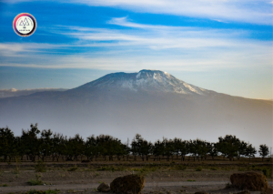
  • Kilimanjaro is the highest mountain in Africa and is one of the 7 summits (the highest mountains of each of the seven traditional continents). It is the fourth highest of the Seven summits and the highest walkable mountain in the world.


  • Kilimanjaro is the highest single free-standing mountain in the world that is it is not part of a mountain range.


  • Not only the highest peak in the African continent, Mt.Kilimanjaro is also one of the biggest volcanoes on Earth, covering an area of approximately 388,500 hectares.


  • Kilimanjaro is the fourth most topographically prominent peak on Earth standing high at 5,895 metres (19,341 ft) that isris­ing approximately 4,900 metres (16,100 ft) above its plateau base and extending across 40km.


  • Mt.Kilimanjaro is part of Kilimanjaro National Park which formed in 1973,with its six surrounding forest corridors to protect its unique environment. The park was named a United Nations Educational, Scientific and Cultural Organization (UNESCO) World Heritage site in 1987.
Geographical overview of Mt.Kilimanjaro


  • Kilimanjaro is located in Tanzania near the Kenyan Border in East Africa, just 320km south of the Equator.


  • It is the highest single free-standing mountain in the world that is it is not part of a mountain range.The closest mountain to Kilimanjaro is Mount Meru which is over 60km south-west from Mt.Kilimanjaro.


  • Kilimanjaro is a dormant stratovolcanoformed by the force of fire and ice. It was formed over 750,000 years ago when the lava burst through the fractured surface of Great Rift Valley creatingShira volcano. Mawenzi and Kibo were formed from the subsequent eruptions about 1 million years ago. Mawenzi and Kibo, ‘melted’ together after the eruptions. They are separated by the Saddle Plateau at 4,400 metres (14,400 ft).

  • So, Mt.Kilimanjarois made up of three distinct volcanic cones:
  • Kibo, the highest oneis dormant which the scientists believed to haveerupted 360,000 years ago. However it could erupt again.A huge eruption led to the formation of Kilimanjaro’s characteristic shiny black stone – which is just a solidified black lava or obsidian.Subsequent eruptions created a series of distinctive mini-cones, or parasitic craters, that run in a chain south-east and north-west across the mountain, as well as the smaller Reusch Crater inside the main Kibo summit. The last volcanic activity left a symmetrical inverted cone of ash in the Reusch Crater, known as the Ash Pit,that can still be seen today.Kibo is classified as being dormant rather than extinct, as testified by anybody visiting the inner Reusch Crater. A strong sulphur smell still rises from the crater and the earth is hot to touch, preventing ice from forming. Occasionally fumaroles escape from the Ash Pit that lies at its heart.
  • Mawenzi, also known as Hans Meyer Peak stands at 5,149 metres (16,893 ft) and is extinct.
  • Shira, the lowest one is at 4,005 metres (13,140 ft) and is also extinct. It collapsed and got filled in by Kibo’s lava creating the current Shira plateau.


  • Uhuru Peak or Kaiser Spitze is the highest summit on Kibo’s crater rim toweringat 5,895 m (19,341 ft).Uhuru is the Swahili word for “freedom.”The southern lip of Kibo’s crater rim is slightly higher than the rest of the rim and Uhuru is the highest point on this southern lip.


  • Kilimanjaro even have a crater lake namedChalalake (aka Jala) that lies 30km to the south-east and is said to be up to 2.5 miles deep.


  • There are seven official trekking routes to ascend Mt.Kilimanjaro:
  • Lemosho route
  • Machame route (Wiskey route)
  • Marangu route (Coca-cola route)
  • Northern circuit route
  • Rongai route
  • Shira route
  • Umbwe route
  • Western breach route (re-opened recently)
  • Mweka route is used only for descend.


  • These trails meet up at around 4000m with a path that loops right around the Kibo summit. This path is known as the Kibo Circuit, though it’s often divided into two halves, known as theNorthern and Southern circuits.


  • So there are 3 summit passages to Mt.Kilimanjaro and all the routes take either of these 3 summit passages to reach Uhuru peak. These summit passages are via:
  • Stella point
  • Gilman’s point
  • Western breach


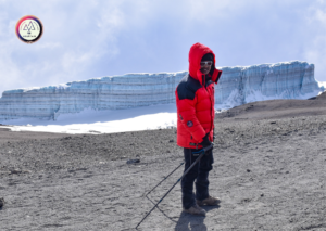
  • Kilimanjaro’s glaciers are fascinating structures of the ice columns and pillars, towers and cathedrals made up of gleaming blue-white ice.
Marangu Route

  • This route famously known as “Coca Cola” or “Tourist” route is the easiest and the most popular route to the summit.


  • It is both an ascent and descent trail.


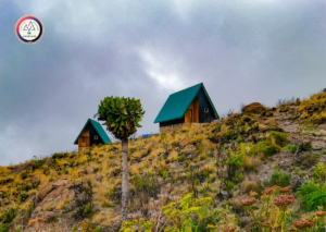
  • This is also the only route with the comforts of sleeping huts at every camp site with solar lights and comfortable beds. The huts provide a good shelter during the harsh weather which assures comfortable sleep. Bathrooms and running water are available at the two lower huts.

  • Breath-taking view of Kilimanjaro’s Mawenzi and Kibo peaks are an added advantage of taking this route.


  • Marangu route offers 6 days itinerary to ensure adequate acclimatization as Mt.Kilimanjaro is known to be challenging in terms of combating Acute Mountain Sickness.
Flora of Mt.Kilimanjaro

It is said that to climb up Kilimanjaro is to walk through four seasons in four days. Thanks to the vast variety of flora one encounters during the trek.

Be prepared to experience a variety of eco-systems during Kilimanjaro trek: Tropical jungle, Savannah desert, Montane forest, Subalpine and Alpine vegetation…..all in one trek….!!!

The variety of flora found on Kilimanjaro can be ascribed in part to the mountain’s tremendous height and in part to its proximity to both the equator and the Indian Ocean.

Natural forests cover about 1,000 square kilometres (250,000 acres) on Kilimanjaro.

  • Forest zonelies just above the cultivated zone(the lowest zone) and houses the greatest variety of both fauna and flora.

Montane forest zone: Impatiens kilimanjari (semi-official ’emblem’ of Kilimanjaro; also known as the ‘elephant’s trunk flower’),Viola eminii, Impatiens pseudoviola

  • Low alpine zone lies immediately above the forest zone.

Grasses dominate this zone. Protea kilimandscharica, Kniphofiathomsonii (aka Red-hot poker) are some of the plantations in this zone.

  • Moorland zoneis what lies further above. The hallmark of this zone is Senecio or giant/ tree groundsel. Other distinct plant in this zone is lobelia deckenii.


  • Alpine desert zone is around the region of saddle where plants have to survive in drought conditions. You will see Asteraceae, a bright yellow daisy-like flower in this zone.


  • Arctic summit:Kibo is almost devoid of vegetation as there is virtually no water. However, lichen- Helichrysumnewii have been found in the Reusch Crater andis said to exist right up to the summit.


  • The Tussock Grassland is an area on the slopes of Mt.Kilimanjaro that contains many unique species of vegetation such as water holding cabbage.
Fauna of Mt.Kilimanjaro

Large animals are rare on Kilimanjaro and are more frequent in the forests and lower parts of the mountain.

Elephants and Cape buffaloes are among the animals that can be potentially dangerous to the trekkers.Giraffes have been known to wander onto the lower slopes. Bushbucks, Chameleons, Dik-diks, Duikers, Mongooses, Sunbirds, Warthogs,Bush pig (with its distinctive white stripe running along its back from head to tail),Honey badger (most powerful and fearless carnivores for their size in Africa),Aardvark (entirely benign as aardvark never killed anyone) are also found here.

Zebras, leopards and hyenas have been observed sporadically on the Shira plateau.

Specific species associated with the mountain include the Kilimanjaro shrew and the Chameleon-Kinyongiatavetana,Blue monkey (Cercopithecusmitis).The blue monkeys, which appear frequently near the Mandarahuts are not actually blue but grey or black with a white throat.

Four-striped grass mouse are frequently spotted in Horombo Huts on the Marangu Route.Other rodents present are Harsh-furred and climbing mouse and Mole rat, though rarely seen.

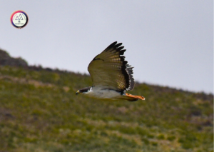
One is much more likely to experience the array of birds on Kilimanjaro from Malachite sunbirds to Mountain buzzards and even Crowned Eagles. Bird-lovers look for:noisy dark green Hartlaub’sturaco (bright red under-wings when it flies), silvery-cheeked Hornbills, speckled Mousebirds, Trogon,Ruppell’s robin chat (black and white head, grey top, orange lower half), common Bulbul (with a black crest and yellow beneath the tail).Don’t miss the most beautiful bird on this mountain- dazzling scarlet-tufted Malachite sunbird.

Climatic overview of Mt.Kilimanjaro

  • The climate of Kilimanjaro is influenced by the height of the mountain(which allows the simultaneous influence of the equatorial trade winds and the high altitude anti-trades) and by the isolated position of the mountain. Kilimanjaro has daily upslope and nightly downslope winds(regimen stronger on the southern than the northern side of the mountain).


  • Kilimanjaro has two distinct rainy seasons.
  • Strong winds travel across the oceans, drawing moisture up as they go. Finally they collide with a large object – such as a mountain like Kilimanjaro. The winds are pushed upwards as they hit the mountain slopes, and the fall in temperature and atmospheric pressure leads to precipitation (snow and rain). In one year there are two rain-bearing seasonal winds. The south-east trade wind bringing rain from the Indian Ocean arrives between March and May. This season is known as the long rains and main wet season on Kilimanjaro. Then there are the dry ‘anti-trade’ winds from the north-east which carry no rain and hit Kilimanjaro between May and October. These anti-trade winds blow very strongly across the Saddle also serve to keep the south-east trade winds off the upper reaches of Kilimanjaro, ensuring that the rain from the long monsoon season stays largely on the southern side.
  • A second seasonal rain-bearing wind, the north-east monsoon, having already lost much of its moisture after travelling overland for a longer period, brings a short rainy season between November and February.


  • The average temperature at the base of the mountain is 21 – 27°C, whilst the average temperature at the summit is approximately -7°C. Nighttime surface temperatures on the Northern Ice Field (NIF) fall on average to −9 °C (16 °F) with an average daytime high of −4 °C (25 °F). During nights of extreme radiational cooling, the NIF can cool to as low as −15 to −27 °C (5 to −17 °F).


  • Snowfall can occur at any time of year but is mostly associated with northern Tanzania’s two rainy seasons. Precipitation in the summit area occurs principally as snow and graupel. Kibo remainspermanently covered in snow.
Why Mt.Kilimanjaro Expedition…?

  • Being a non-technical mountain peak it is more of trekking on Mt.Kilimanjaro than an expedition. So, to summit this one of the seven summits, one need not be a trained mountaineer.


  • The unique and varied pattern of vegetation found in Kilimanjaro is definitely a treat to walk through.


  • The bird-lovers gear up to get that add-on experience during the ascent to Uhuru peak as there is variety of birdie inKilimanjaro.


  • Who will want to miss a chance to walk by the largest Tropical glaciers (ice formations found at high altitudes on mountains along the earth’s equator) of Kilimanjaro, which unfortunately are shrinking and are projected to disappear between 2030 and 2050….!


  • The safari por­tion of the trip will allow you to expe­ri­ence the beau­ti­ful land­scape and wildlife of Tan­za­nia. Me And Mountain organized a tailored Wildlife safari/ game drive in the national parks in Tanzania. Read more to know about our Wildlife adventure in Tanzania https://meandmountain.com/tour/wildlife-safari-in-tanzania-africa/ ‎
Tentative Itinerary
May change as per the local authority permission & availability of accommodation

Day 1Pickup from Kilimanjaro International Airport (KIA)

After arrival at the Airport our guide will transfer you to the Hotel which is found on the foothill of Mt. Kilimanjaro, after check inn you will have tour briefing and equipment check if you will miss some of them he will take you to rent the missing gears when everything clear you will take a rest for next day adventure.

Day 2Drive to Kilimanjaro National Park Marangu Gate, Hike to Mandara Hut

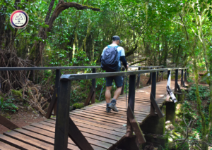
After breakfast and briefing, drive to the Kilimanjaro National Park Gate (about 1 hour), register and commence the climb. Walk through the rainforest to the Mandara encampment. A side trip to Maundi Crater is a good way to see the surroundings including Northern Tanzania and Kenya. In the rainforest, look for towering Eucalyptus trees, bird life, and Colobus monkeys.

 Elevation: 1860m/6100ft to 2700m/8875ft
 Distance: 8km/5mi
 Hiking Time: 3-4 hours
 Habitat: Montane Forest
 Meals: Lunch, Dinner

Day 3Hike Mandara Hut to Horombo Hut

Maundi crater


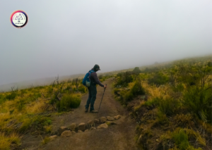
You leave the glades of the rain-forest and follow an ascending path on the open moorlands to the Horombo encampment. Views of Mawenzi and the summit of Kibo are amazing. Look for giant lobelias and grounsels. You may begin to feel the effects of the altitude.

 Elevation: 2700m/8875ft to 3700m/12,200ft
 Distance: 12km/7.5mi
 Hiking Time: 5-6 hours
 Habitat: Heath land
 Meals: Breakfast, Lunch, Dinner

Day 4Hike Horombo Hut to Kibo Hut

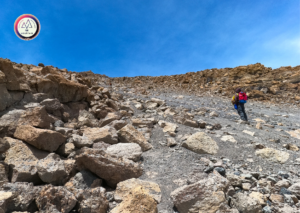
Ascending, we now pass the last watering point, walking onto the saddle of Kilimanjaro between the peaks of Kibo and Mawenzi. Vegetation begins with upper heath land but then disappears into “moonscape”. Dinner, rest, and prepare for summit climb.

 Elevation: 3700m/12,200ft to 4700m/15,500ft
 Distance: 9km/5.5mi
 Hiking Time: 5-6 hours
 Habitat: Alpine Desert
 Meals: Breakfast, Lunch, Dinner

Day 5Hike Kibo Hut to Summit, and down to Horombo Hut

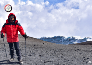
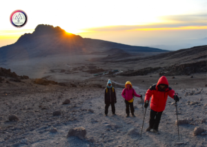
Very early in the morning (midnight to 2 am), commence the climb to the summit on steep and heavy scree or snow up to Gilman’s point located on the crater rim. Continuing, we now ascend to Uhuru Peak, which is the highest point in Africa. There are unbelievable views at every turn. Have your picture taken at the summit to show your friends and family. From here we descend, stopping for lunch and a rest at Kibo before continuing on to the Horombo encampment.
The beginning of this climb is done in the dark and requires headlamps or flashlights. It will be very cold until you start descending, so you will need all of your warm layers. This is by far the
most difficult part of the trek with many switchbacks. Going slowly “pole pole” and an optimistic attitude will get you there!

 Elevation: 4700m/15,500ft to 5895m/19,340ft
 Down to: 3700m/12,200ft
 Distance: 6km/4mi up / 15km/9mi down
 Hiking Time: 6-8 hours up / 15km/9mi down
 Habitat: Alpine Desert
 Meals: Breakfast, Lunch, Dinner

Day 6Hike Horombo Hut to Marangu gate & drive to Moshi

After breakfast, a steady descent takes us down through moorland to the Mandara Hut. Continue descending through lush forest path to the National Park gate at Marangu. At lower elevations, it can be wet and muddy. Gaiters and trekking poles will help. Shorts and t-shirts will probably be plenty to wear (keep rain gear and warmer clothing handy).

A vehicle will be waiting for you at Marangu gate to drive you back to your hotel in Moshi (about 1 hour).

 Elevation: 3700m/12,200ft to 1700m/5500ft
 Distance: 20km/12.5mi
 Hiking Time: 4-5 hours
 Habitat: Forest
 Meals: Breakfast

Day 7Drop to Kilimanjaro Airport

The driver will transfer you to the airport to board your flight in the morning OR if you have more days don’t hesitate to contact us for organiing Jungle safari for you.

Departure Location

Kilimanjaro airport

Return Location

Kilimanjaro airport

Price Includes

  • TransportationPick-up from and drop to Kilmanjaro airport
  • AccommodationAccommodation in tents/huts on sharing basis, Camping essentials: Tents, Mattresses, Kitchen tent with table and chairs
  • FoodAll meals while on the Mountain
  • Support staffProfessional mountain guide, Porters, Cook, Helper
  • Offloading
  • Group climbing equipmentMountaineering ropes, carabiners
  • PermitAll Park fees
  • MedicalEmergency medical kit, Pulse oximeter, BP apparatus, Infrared thermometer, Crisis management and safety procedures

Price Excludes

  • InsuranceRecommended to get an insurance coverage which includes emergency medical, hospitaliation, repatriation expenses
  • In an event of a participant requiring emergency evacuation, he/she will be escorted till the nearest road end from where the further expenses of transportation, hotel/hospital and food shall be managed and borne by that participant. In such unfortunate event the participant won’t be eligible for the refund or adjustment voucher.
  • If a participant deciding on discontinuing the event mid-way due to any circumstance other than medical condition requiring emergency evacuation, he/she will require to do so by signing the 'Discontinuation form' after which he/she is set to go on own. In such situation the participant will neither be eligible for the Refund or the Adjustment voucher.
  • Personal clothing and equipment gears like trekking poles, toiletry and other items mentioned later in things to carry section
  • Any cost escalation (accommodation, food, transportation) due to unforeseen circumstances like landslides, roadblocks, bad weather, pandemic crisis, sudden government policies or regulations
  • Any expense arising out of itinerary will have to be borne by the participant
  • Gratuity/ TipTip is a cultural obligation which the participants are adviced to carry in cash to be directly handed over to the local support staffs at the end of the expedition.

Advisory

  • Always carry the original passport with you during the expedition
  • It is advisable to carry 2 extra passport photos, photocopies of passport and relevant visa pages, proof of insurance
  • In an expedition there are more than 50% chances of facing uncertainty, hence you see it’s mentioned “Tentative” itinerary. Weather conditions, wildlife movements, permission changes can often force the leader to change the itinerary, distance or place
  • Throughout the expedition, starting from the pick up to the drop point, the final decision will be taken by leader and all the trekkers will be expected to abide to the same.
  • All participants are expected to have high level of fitness, stamina and the ability to sustain harsh environments.
  • Every participant will have to undergo a temperature and other vitals check-up every day.
  • Do weigh your gears post packing. It should be on the lighter side for you to carry throughout the expedition.
  • Handy cash for TipTip is a cultural obligation in Africa for which the participants are adviced to carry handy cash to be directly handed over to the local support staffs at the end of the expedition. The locals expect tip from every participant and we are sure that you won't mind bringing smile on their faces on receiving a Tip from you.
  • Group discountAdditional $100/- OFF for each participant if booked for a group of 5 or more (booking to be made together)
Booking terms
Confirmation policy
  • Email on booking@meandmountain.com or WhatsApp on +91-9051055011 the following details: Name of the participant(s), Name of the event, Date of the event, Email address (Note: This is not the Enrolment form) and proceed with the online payment either via the payment link shared via WhatsApp or the payment section on the website.
  • Mode of payment: only online
  • The participants will receive the Confirmation email and Ticket via email within 48 hours.
  • After the confirmation, you will need to send the dully filled, signed and scanned forms (Enrolment, Medical & Self-declaration) to booking@meandmountain.com, before commencement of the expedition.
  • The forms can be downloaded from the links below or ‘FORMS’ section in the home page.
  • It is mandatory for all the participants to submit all 3 forms before the expedition, in absence of which Me and Mountain shall have a full right to deny the entry of that participant to the particular expedition.
Cancellation policy
  • Cancellation done by 60 days before the commencement of the expedition: 100% of payment will be refunded.
  • Cancellation done between 45 days to 60 days before the commencement of the expedition: 50% of payment will be refunded.
  • In case of cancellation done within 45 days before the commencement of the expedition, the amount shall be adjusted in any of the events done later with ‘Me and Mountain’.
Discontinuation policy
  • In an event of a participant deciding on discontinuing the event mid-way due to any circumstance other than medical condition requiring emergency evacuation, he/she will require to do so by signing the ‘Discontinuation form’ after which he/she is set to go on own. In such situation the participant will neither be eligible for the Refund or the Adjustment voucher.
Forms
Diet recommendation
  • Consume less spicy diet at least 7 days prior to the expedition
Things to carry
Layering the upper body during trek
  • Layer-1: Body warmer
  • Layer-2: Dry-fit T-shirts
  • Layer-3: Fleece jacket
  • Layer-4: Down/ synthetic padded Jacket
  • Layer-5: Hard shell wind & waterproof jacket with hood
  • Layer-6: Heavy down coat
  • Gloves: Lightweight poly-liner gloves; Mid-weight soft shell gloves – water/wind resistant; Heavy- weight waterproof gloves with removable liner; Expedition weight mittens with fleece mitt liner
Lower body during trek
  • Layer-1: Synthetic underwear
  • Layer-2: Medium or expedition weight thermal bottoms
  • Layer-3: Trekking trousers
  • Layer-4: Waterproof/breathable pants with full side zips
  • Layer-5: Heavy insulating pants - Down or synthetic pants will full zips
  • Polyester/ active-wear socks
  • Trekking boots
Layering the upper body in the campsite
  • Layer-1: Body warmer
  • Layer-2: Dry-fit T-shirts
  • Layer-3: Sweater
  • Layer-4: Another layer of sweater
  • Layer-5: Fleece jacket
  • Layer-6: Down/ synthetic padded Jacket
  • Gloves
Layering the lower body in the campsite
  • Layer-1: Synthetic underwear
  • Layer-2: Body warmer
  • Layer-3: Polar fleece or soft shell pants
  • Layer-4: Trekking trouser
  • Polyester/ active-wear socks
  • Woolen socks
Clothing for layering upper and lower body
  • 4-5 Dry-fit T-shirts
  • 1 Fleece jacket
  • 1 Down/ synthetic padded Jacket to withstand sub-zero temperature
  • 1 Hard shell wind & waterproof jacket with hood
  • 1 Heavy down coat - a very warm down coat with hood or an 8,000m coat with hood
  • 2 Sweaters
  • 2-3 pairs of Trek pants
  • Medium or expedition weight thermal bottoms
  • Polar fleece or soft shell pants
  • Waterproof/breathable pants with full side zips
  • Heavy insulating pants - Down or synthetic pants will full zips
  • 2 sets of Body warmers (polyester, avoid cotton)
  • 4-5 pairs of Socks meant for active-wear (blend of woolen & synthetic fabric) for wearing during the expedition
  • 4-5 pairs of Woolen socks for wearing at the campsites
  • 4 pairs of well insulated Gloves:Lightweight poly-liner gloves Mid-weight soft shell gloves – water/wind resistant; Heavy- weight waterproof gloves with removable liner; Expedition weight mittens with fleece mitt liner
Headgear
  • Helmet
  • Buff/neck gaiter
  • Woolen cap, big enough to cover the ears along with the head
  • Woolen balaclava, covering the neck, mouth & nose
  • Sun cap with a back flap to protect the nape of the neck
Footwear
  • Trekking Boots:waterproof trekking shoes with ankle support and good sole
  • Trainers, running shoes and/or sandals for campsite to be worn with woolen socks
Gears
  • Large rucksack/backpack: 80+ litres with rain cover
  • Daypack/ Summit pack: 20-30 litre with rain cover
  • Large (120+ litres) duffel kit bags for clothing and equipment
  • Small luggage locks for duffel kit bags
  • Glacier sunglasses with side shields
  • Ski goggles with light and dark lenses
  • Trekking poles (preferably a pair)
  • Headlamp with extra batteries and bulbs
  • Water Bottles: 1 Thermos & 1 regular bottle of 1 litre capacity
Other essential items
  • Quick dry towel
  • Toilet kit
  • Wet wipes
  • 2 Tissue rolls
  • Sunscreen: SPF 40+
  • Personal medical kit
  • Mosquito repellent cream
  • Hand sanitizer gel (small bottle)
  • Bar of soap
  • Extra prescription glasses/contact lenses and supplies
  • Snacks for personal consumption
  • Self-heating warming pouches (available online)/ hot water bag to keep yourself warm at night
  • Ladies: Menstrual hygiene products with zip lock bags to carry back waste for disposal. Menstrual cups are recommended over tampons /sanitary napkins.
  • Pee bottle (1 litre or larger)
Photos