+91 9051055011 | +91 8969336262 info@meandmountain.com

Login

Sign Up

After creating an account, you'll be able to track your payment status, track the confirmation and you can also rate the tour after you finished the tour.
Username*
Password*
Confirm Password*
First Name*
Last Name*
Birth Date*
Email*
Phone*
Country*
* Creating an account means you're okay with our Terms of Service and Privacy Statement.
Please agree to all the terms and conditions before proceeding to the next step

Already a member?

Login

Hampta pass trek

0
Easy to Moderate
Booking Form
Enquiry Form
Full Name*
Email Address*
Travel Date*
People*
Your Enquiry*
* I agree with Terms of Service and Privacy Statement.
Please agree to all the terms and conditions before proceeding to the next step
* Please select all required fields to proceed to the next step.

Proceed Booking

Save To Wish List

Adding item to wishlist requires an account

73

[trustindex no-registration=google]

5 days
Availability : 12-07-2024, 26-07-2024, 02-08-2024, 16-08-2024, 30-08-2024, 13-09-2024, 27-09-2024
Jobra
Chatru
Min Age : 12+

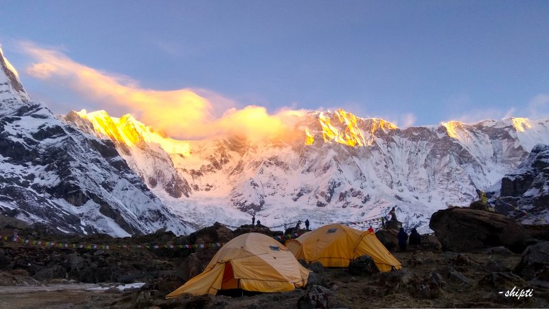
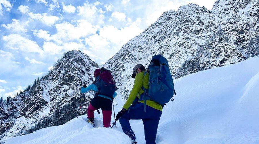
Glimpse of Hampta pass trek:

Location: Himachal Pradesh, India

Duration5 Days

Trek gradientEasy to Moderate

Maximum Altitude: 4,297 m/ 14,100 ft. above sea level

Distance: 26 Km

Pickup/ Drop PointJobra & Chatru

Temperature:

  • April-May: 21˚to 25˚(Day); 6˚to 9˚(Night)
  • June-October: 22˚to 26˚(Day); 15˚to 5˚(Night)
  • December-March: 11˚to 16˚(Day); -4˚to 2˚(Night)

Customized fees:

Fees based on the final number of participants. Kindly contact +91-9051055011/ +91-8969336262 for the further detail before proceeding for the payment.

Overview of Hampta pass trek

Hampta Pass is one of the rarest and dramatic crossovers trekking in the Himalayas. It is a small corridor located between the Kullu valley and Lahaul’s Chandra Valley of Himachal Pradesh, India. At 14,000 feet, in the Himachal Pradesh is located this beautiful pass crossing where the scenery keeps changing drastically. It starts from the lush green valley of Kullu and ends in Spiti’s air desert, which makes the Hapmta pass so distinct from others. In this single trek, you will first go through the alpine forests and see ample Maple, Birch, Oak, Deodar, and then enter the wide meadows. Walking right next to the streams, you will soon be able to see the snowline, and once you reach this point, there is a steep ascent all the way to the pass. The biggest attraction till this point is the wide variety of wildflowers. Where ever you look, you’ll see beautiful flowers blooming on the side of your trail. Hampa Pass is known as the Himachal’s Valley of Flowers as the landscape is truly similar to the Valley of Flowers. A narrow green Valley with big mighty rocks covered by a sheet of flowers protected by the snow-covered mountains is the ultimate definition of beauty. In the Hampta pass, you can see three scene changes in just two days ( from alpine forest to green meadows and finally to moraine), and that’s what makes this so special. After getting on the other side of the Hampta pass, the total contrast and the dramatic change in the scenery will leave you in a state of shock. Right after crossing the valley with this rich flora, a barren stretch with rugged terrains and blue sky appears before our eyes. This is known as the Spiti Valley. This feeling is something that makes Hamta Pass so special; at the same time, you can see a green valley on one side and a cold desert valley on the other, and this memory will be live with you for the rest of your life.

Now more about the trek. There will be two water crossings during the trek, and you need to cross the stream through icy cold water. This can be the most thrilling experience as one wrong step can dip you in ice water. The best time for this trek is between June to September. The temperature generally ranges between 10 to 18 degrees Celsius during the day and between 0 to 5 at night. This gives an ideal temperature range for travelers to enjoy the trek. The trek can go to high altitudes 14100 ft that being the highest point, and the temperature might drop to sub-zero at sites like BalukaGhera and Shigeru. Finally, the most beautiful location here is Chandrataal. “Taal” means a lake, and Chandra means moon; Chandrataal truly deserves this name as the crystal clear water of this lake reflects the beauty of the night sky as a divine picture. This lake is situated at the SamudraTapu Plateau. An interesting fact about this lake is that it has no clear source of water, but an outlet is present. It is believed that Lord Indra’s chariot picked Yudistira from this place and as a result of this divine incident, water gushed out from under the ground creating a lake right at the middle of a plateau. 

Why Hampta pass trek ?

The Hampta Pass Trek starts off at Manali and ends at the magnificent Chandratal but anyone would agree it’s the journey that is more memorable.

Jobra- At a distance of 18km from Manali, Jobra the basecamp of the Hampta pass trek is a 2-hour drive. Anyone would find themselves glued to the window especially the ones sitting on the left side. Crossing over 30 hair-pin bends the drive may be testing but equally rewarding. Traversing this terrain one will lay witness to the change of landscapes shifting from apple orchids to deodar forest to great oaks. You would feel Manali to be warm and cosy as the temperature around will keep dropping as we drive up the mountain dirt track to an altitude of 9800ft. Jobra being the base-camp of the Hampta pass trek is also a wonderful campsite boasting an array of campsites and a couple of cosy lodges for weary trekkers.       

Chika- Situated at over 10000ft Chika is a couple hours of hike away from Jobra The 2km on-foot trek starts from AllainGuhugal hydel project junction. Crossing the main road, the trek continues on to a narrow path leading to a pine forest. The mystical forest also hosts a sprinkle of maple, deodar and oak at intervals. The 2-hour trek Starts with a gentle slope leading us to the half hour mark when a bend with a huge boulder comes into sights overlooking lush green meadow embroidered with tiny rocks. Going in further into the meadow you will be greeted by the silk blue Rani river flowing between the meadow and while you take a minute to take in the beauty of the landscape, a few grazing cows and sheeps might keep you in company. You may pass through the meadow or climb and descend the left hill to reach the Chilka. Once reached you will be greeted with the Chika camp-site, a vast patch of green meadow decorated with the Rani river flowing in the middle.  

Balu ka ghera- In the trek from Chika to BalukaGhera one will spend quarter of a day scaling through 8.5km distance gaining another 1900ft in altitude. The journey starts from Chilka camp-site following along the “left-bank” of the river on the right side, the trail leads on to a slope of rocky terrain and boulders. To the “right-bank” of the river stretches of beautiful flora comes into sight. Dwarf Rhododendron trees graces the lower and central regions with a cluster of silver birch decorating the upper regions. At the end of the silver birch stealing the lime-light are the grand snow-clad peaks of the Dhauladhar range. Trekkers running low on water may stop for a quick top-up from the natural waterfall towards the left at a distance. Crossing the waterfall, the journey continues onto the other side of the river. Fording the river the trekkers will have to dip their feet in icy-cold water although skipping over stones is also an option. Reaching Jwara marks the half-way point of the trek, Jwara is a picturesque sheltered valley decorated with colourful flowers between huge snow-clad boulders on one side and a valley merging with the river on the other. With the last of the trees fading in the background we leave Jwara behind on a slope of snow and rocks leading us to BalukaGhera. The BalukaGhera camp-site at an altitude of almost 12000ft is a flat ground amidst the grand Himalayas by the river delta with the view of the Hampta pass right infront.     

Hampta Pass- At a staggering altitude of 14000ft Hampta pass is the highest point of the entire journey. The trek starting from BalukaGhera is along the river trail towards the base Hampta pass. Along the way the landscapes covered in flowers of yellow and orange makes for natures tapestry. From the base of the pass the climb starts and on the 2-hour mark the first plateau comes into view. Covered with white snow the sights are nothing short of heavenly. From there the trek leads on to another plateau towards a half hour long ridge. Climbing up finally leads us to the 2nd ridge and although the Hampta pass is just a bend and a few meters away, getting there is not a cake-walk. The climb gets really steep and testing but upon reaching the hard-work is well rewarded by the epic 360 view along with the feeling of being at the top of the world, The adrenalin rush will send in jolts of joy all throughout your body.

Sita goru- After basking in the beauty of the Hampta pass Sitagoru is the next destination. The route to Sitagoru is a steep descend and will test your mountaineering skills to its limits. For some perspective the descend is so steep that one cannot make out the base of the mountain just by looking down. The way down is winding and often the best way to descend down is to slide down the slopes with ropes. Along the way the beautiful Spiti comes into view.  Within an hour and a half, you will reach the base of the valley barriered by lofty mountains with the only way open is towards Sitagoru. The journey from there is largely on flat-land leading to the river-side camp of Siagoru.

Chatra- At a distance of 7km from Sitagoru, Chatra is a 5hour descend away at an altitude of 11000ft. The trek to Chatra is a gentle and laid-back along the towering mountains on one side and calm flowing rivers on the others. The senary will largely be of barren mountain slopes with an occasional splash of green. Along the way we will cross the Chandra river along with 2 glaciers taking us to Chatra, an amazing and unique camp destination  with the magnificent view of 3 passes, Hampta, Rohtang and Spiti.

Chandratal- At 45km from Chatra, Chandratal is a 5 hour drive away. The blue crescent lake enveloped in lush green makes up for a picture-perfect spot for a camp and a bon-fire. Although reaching chandratal is largely dependent on the whims of weather.  

Manali- “A journey of a thousand miles starts with a single step” likewise ours does at Manali. At an altitude of 6610ft this lovely township nestled in the picturesque Beas river valley is truly an embellishment of the Himalayas.  

Pick up location

Jobra

Drop location

Chatru

Price Includes

  • Camping accomodation during trek on sharing basis
  • Camping essentials: Dome Tents, Kitchen tent, Toilet tent (traditional pit style), Sleeping bag, Harness & Carabineers
  • Breakfast, Lunch, Evening tea, Dinner during trek
  • Guide, Group Porter, Cook, Helper.
  • Stretcher evacuation
  • Portable Oxygen cylinder, Pulse oximeter, BP apparatus, Infrared thermometer & other staffs
  • Permits

Price Excludes

  • Travel Insurance
  • Transportation from Manali to Jobra and Chatru to Manali. Transportation can be arranged whose payment will be made directly to the driver by trekkers
  • Off loading
  • In an event of a trekker deciding on discontinuing the trek midway due to any circumstance/ evacuation, he/she will be escorted till the nearest road end from where the further expenses of transportation, hotel/ hospital and food shall be managed and borne by that trekker. In such unfortunate event the trekker won’t be eligible for the refund.
  • Personal trekking gears like clothings, trekking shoes, trekking poles, toiletry and other items mentioned later in things to carry section.
  • Any cost escalation (accommodation, food, transportation) due to unforeseen circumstances like landslides, roadblocks, bad weather, pandemic crisis, sudden government policies or regulations
  • Any expense arising out of itinerary will have to be borne by the Trekker
  • Gratuity/ Tip

Advisory

  • Always carry a valid original photo ID card with you
  • Phone network of Airtel is available till Manali. Although the connectivity is erratic. There won't be phone network during the trek.
  • Trekking is an activity where there are more than 50% chances of facing uncertainty, as you see it’s mentioned “Tentative” itinerary. Weather conditions, wildlife movements, permission changes can often force the trek leader to change the itinerary, distance or place.
  • Throughout the trek, starting from the pick up to the drop, the final decision will be taken by the trek leader and all the trekkers will be expected to abide to the same.
  • All participants are expected to have a fitness level, stamina and the ability to sustain harsh environments.
  • Every trekker will have to undergo a temperature and other vitals check every day.
  • Do weigh your Gears post packing. It should not exceed the range of 8-10 kg – preferably on the lighter side.
  • The last reliable ATM is at Manali.
Booking terms
Confirmation policy
  • Email on booking@meandmountain.com or WhatsApp on +91-9051055011 the following details: Name of the participant(s), Name of the event, Date of the event, Email address (Note: This is not the Enrolment form) and proceed with the online payment either via the payment link shared via WhatsApp or the payment section on the website.
  • Mode of payment: only online
  • The participants will receive the Confirmation email and Ticket via email within 48 hours.
  • Ater the confirmation, you will need to send the dully filled, signed and scanned forms (Enrolment, Medical & Self-declaration) to booking@meandmountain.com, before commencement of the expedition.
  • The forms can be downloaded from the links below or ‘FORMS’ section in the home page.
  • It is mandatory for all the participants to submit all 3 forms before the expedition, in absence of which Me and Mountain shall have a full right to deny the entry of that participant to the particular expedition.
Cancellation policy
  • Cancellation done any time after the booking of the event shall be adjusted in any event later with ‘Me And Mountain Global Adventures Pvt Ltd’ only via Adjustment voucher. The Adjustment voucher will be valid for 1 year from the date of the event cancelled.
  • Refer the section on Cancellation/Refund Policy for the detail cancellation policy.
Discontinuation policy
  • In an event of a participant deciding on discontinuing the event mid-way due to any circumstance other than medical condition requiring emergency evacuation, he/she will require to do so by signing the ‘Discontinuation form’ after which he/she is set to go on own. In such situation the participant will neither be eligible for the Refund or the Adjustment voucher.
Forms
Reaching Basecamp

In order to reach our basecamp i.e. Jobra, we need to reach Manali first. It’s a 2 km drive from Manali to Jobra and it takes 2 hours. You can rent cabs and its not included in the trek fee. 

By Bus
Taking an overnight bus to Manali

  • Buses from Chandigarh to Manali takes 10 hours.(Best option)
  • Buses from Delhi to Manali takes 14 hours

By Air

Taking a flight

  • Taking a flight from Delhi/Chandigarh airport, and then travelling by bus to   Manali. (Best option)
  • Taking a flight to Bhuntar Airport, Manali is just a couple of hours away and you can easily get a bus or a private taxi till there.(Not recommended)

By Train
One can take a train to Pathankot, from where direct buses to Manali are available. It is 300 km from there and would take an overnight journey to reach Manali. Once reached you need to book a cab which will drop you at Jobra, our basecamp.

Tentative Itinerary
May change as per the local authority permission & availability of accommodation

Day 1Manali To Chika Via Jobra

  • Altitude: Jobra 9,800 ft (2,987m)to Chika 10,100 ft (3078m)
  • Distance:  21 kms drive and 4.5 kms trek
  • Time Taken: 1 hour drive and 3 hours trek

It’s a 2km drive from Manali to Jobra and it takes 2 hours. Then we have to take  a 45 minutes trek from Jobra to Chika. The cab fare is Rs.2,500 per vehicle. This is not included in the trek fee. It is to be shared by the trekkers and paid to the driver directly. The trails are easy to moderate, water points are available on the way and the day ends with staying at the tent.

Day 2Chika to BalukaGhera

  • Altitude: 10,100ft (3,078m) to 11,900ft (3,627m)
  • Distance:  8.5 kms trek
  • Time Taken: 6 hours trek

Its an 8.5Km trek which takes 6 hours to reach Balu ka Ghera from Chika. Its a moderate trail with gradual ascent and we will provide packed lunch. We will walk to Chika for about an hour followed by 2 hours of ascent through a boulder section and then descent into level walk. We will be crossing rivers, also there are boulder walk and tiny colourful flowers throughout the way. After reaching BalukaGhera we’ll be stay at tents.

Day 3BalukaGhera to Siagoru, Crossing (Hampta Pass)

  • Altitude: 11,900ft (3,627m) to 14,100ft (4,297m)(Hampta Pass) to 12,900ft (3,931m)
  • Distance:  7 kms trek
  • Time Taken: 10 hours

It’s a 7 km trek and may take approximately 10hrs to reach Hampta Pass from BalukaGhera. There are no water points on the way depending on the snow condition. First 1 hour we will gradual ascent followed by steep ascent till the pass. We will provide packed lunch at the pass. Also we can enjoy the scenic view of Indrasan peak. Later we will take a 2 hours of steep descent and 1 hours of flat walk from the Pass to camp sight. It is the coldest place of the trek. The day ends with staying in the tent.

Day 4Siagoru to Chatru drive to Chandratal

  • Altitude: 12,900ft (3,931m) to 11,000ft (3,352m)
  • Distance:  7 kms trek
  • Time Taken: 5 hours trek

We have to take a 7Km trek and it will take 5hr to reach Chandratal from Siagoru. We will gradually descent on moraine. We will start early in the morning. There are 2 to 3 water sources on the way. We will provide lunch at camp. Later we will drive to Chandratal and back to camp site, either on day 4 or day 5 depending on road and weather condition.

Day 5Chatru to Manali via Rothang Pass

  • Distance:  85 kms drive
  • Time Taken: 5-6 hours trek

In order to reach Chatru to Manali we need to drive 85kms and it takes approx 4 to 6 hours to reach basecamp. We will serve breakfast at camp site and lunch will be provided on the way. Our journey will continue straight down Rothang pass road, which is a very busy route; and driving duration may increase due to of heavy traffic.

Diet recommendation
  • Consume less spicy diet at least 7 days prior to the expedition
Fitness training
  • Cardiovascular training:
  • Stair Climbing
  • Push-Ups+
  • Squats
  • Crunches
  • Burpees
  • Jogging/ Interval Running
  • Free hand stretching
  • Walk daily at least 2-3km
Things to carry
Layering the upper body during trek
  • Layer-1: Dry-fit T-shirt
  • Layer-2: Fleece jacket
  • Layer-3: Down/ synthetic padded Jacket
  • Layer-4: Hard shell wind & waterproof jacket with hood
  • Gloves: Lightweight poly-liner gloves; Mid-weight soft shell gloves – water/wind resistant
Layering the lower body during trek
  • Trekking trousers
  • Polyester/ active-wear socks
  • Trekking boots
Layering the upper body in the campsite
  • Layer-1: Body warmer
  • Layer-2: Dry-fit T-shirts
  • Layer-3: Sweater
  • Layer-4: Fleece jacket
  • Layer-5: Down/ synthetic padded Jacket
  • Gloves
Layering the lower body in the campsite
  • Layer-1: Body warmer
  • Layer-2: Trekking trouser
  • Polyester/ active-wear socks
  • Woollen socks
Clothing for layering upper and lower body
  • 3 Dry-fit T-shirts
  • 2-3 pairs of Trek pants
  • A set of Body warmers (polyester, avoid cotton)
  • 1 Fleece jacket
  • 1 Down/ synthetic padded Jacket to withstand sub-zero temperature
  • 1 Sweater
  • 4-5 pairs of Socks meant for active-wear (blend of woollen & synthetic fabric) for wearing during the trek
  • 2-3 pairs of Woollen socks for wearing at the campsites
  • 1 pairs of well insulated Gloves
  • 1 wind + waterproof Jacket
  • Rain jacket
Headgear
  • Woollen cap, big enough to coverthe ears along with the head
  • Balaclava, covering the neck, mouth & nose
  • Sun cap with a back flap to protect the nape of the neck
Footwear
  • High-ankle boots (waterproof & with good insulation)
  • Slippers/floaters for campsite to be worn with woollen socks
Gears
  • Rucksack: 60-70 litre with rain cover
  • Daypack: 20-30 litre with rain cover to carry water, snacks and personal items
  • Sunglasses with UV protection
  • Quick dry towel
  • Trekking poles (preferably a pair)
  • Headlamp with extra batteries
  • Water Bottles: 1 Thermos & 1 regular bottle of 1 litre capacity
Other essential items
  • Toilet kit
  • 2 Tissue rolls
  • Sunscreen: SPF 40+
  • Personal medical kit
  • Snacks for personal consumption
  • Self-heating warming pouches (available online)/ hot water bag to keep yourself warm at night
  • Ladies: Menstrual hygiene products with zip lock bags to carry back waste for disposal. Menstrual cups are recommended over tampons /sanitary napkins.
Photos