+91 9051055011 | +91 8969336262 info@meandmountain.com

Login

Sign Up

After creating an account, you'll be able to track your payment status, track the confirmation and you can also rate the tour after you finished the tour.
Username*
Password*
Confirm Password*
First Name*
Last Name*
Birth Date*
Email*
Phone*
Country*
* Creating an account means you're okay with our Terms of Service and Privacy Statement.
Please agree to all the terms and conditions before proceeding to the next step

Already a member?

Login

Friendship Peak trek

0
Difficult
Booking Form
Enquiry Form
Full Name*
Email Address*
Travel Date*
People*
Your Enquiry*
* I agree with Terms of Service and Privacy Statement.
Please agree to all the terms and conditions before proceeding to the next step

Available date:
28-05-2024

CUSTOMIZED:
Fees based on the final number of participants. Kindly contact +91-9051055011/ +91-8969336262 for the further detail before proceeding for the payment.

You will be directed to the secured payment gateway on clicking the button.

Proceed Booking

Proceed Booking

Save To Wish List

Adding item to wishlist requires an account

296

[trustindex no-registration=google]

7 days
Availability : 28-05-2024
Dhundi
Dhundi
Min Age : 15+

Glimpse of Friendship Peak trek:

Location: Himachal Pradesh, India

Duration:  7 Days

Trek gradient: Difficult

Maximum Altitude: 5,289 m/ 17,353 ft. above sea level

Distance: 35 Km

Pickup/ Drop Point: Dhundi

Temperature:

  • May-June: 10˚to 15˚(Day); -6˚to 4˚(Night)
  • July-August: 15˚to 12˚(Day); 4˚to -1˚(Night)
  • September-November: 14˚to 10˚(Day); 2˚to -6˚(Night)

Cuscomized fees:

Fees based on the final number of participants. Kindly contact +91-9051055011/ +91-8969336262 for the further detail before proceeding for the payment.

Overview of Friendship Peak trek

Nestled beautifully in between the Pir Panjal and the Dhauladhar range the Friendship peak is an arena where mesmerizing views of the tallest mountains of the lesser Himalayas take the centre stage. Standing at 5289 M, at the peak you will be up close with the Hanuman Tibba and other neighbours such as Deo Tibba, Seven Sisters, Indrasan, Priyadarshani and other glorious giants, even the mountain ranges in Lahaul would be in sight.

The route to the Friendship peak is a difficult trail perfect for Adrenaline junkies and challenging the seasoned trekkers. The 7-day long journey will unravel the uncharted beauty of the Solang valley Infront of you. Over the 35km of trail we will encounter high altitudes, harsh unpredictable temperatures, icy mountain streams, trails of rocks covered in snow and many more challenges, but the people who attempted this trek say that the thrill of the expedition and the magnificent sights refuels your zeal and excitement.  The trail of trek will take you from beautiful lush green meadows to alpine forests of Oak; you will be trekking through ravines and moraines across glaciers carefully placing your grip on snow covered boulders. This trek will require you to be well equipped as we will be needing to travel through the tough terrain using ice-axes with heavy snow boots.

The best time for the trek would be May to July if you are a snow lover; expect to find a snow covered peak with thick sheets of crème white snow along the way. The other great choice of time will be from September and October; you will be at the heart of mother nature right along side the beautiful birds and unique wildlife all peaking a glance from the bloom of flora and lush green vegetations all around. From tough snowy climbs to beautiful sunsets and sunrises from the base camp the Friendship peak trek is sure to engrave itself deep into your minds as it has with us.

Why Friendship Peak trek ?

A perfect expedition:

Friendship Peak is regarded as a transition point between hiking and climbing. Despite being classified as a hiking peak by the IMF, it possesses all of the characteristics of an expedition. You can’t cut corners on the peak, no matter how little it is. Along with the arduous ascent and even more difficult terrain, the summit requires you to acquire some rigorous mountaineering methods including rope up, ascending and descending in the snow, using snow boots and crampons, and, obviously physical and mental stamina. While you have to pull your hands out of your gloves and put the metal crampons in sub-zero temperatures for a night climb or while standing on a thin ledge on the side of a hill with a big pack on your shoulders,  , then you get to know the real distinction between a trek and an expedition.

Another feature that makes it feel more like an expedition is indeed the load ferry. Apart from the Summit Day, you can discharge your luggage on all other days. ‘You bring-you-carry’ is the mantra after you’ve arrived at Summit Camp. Each gramme with your backpack on yours back seems like a kilogram at such a high height, with such cold temperatures and strong winds. At the very least, the hills will train you how to pack light and distinguish between necessary and non-essential items.


Sunrise from the Col :

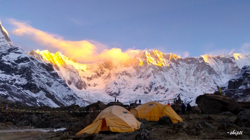
On Summit Day, half way up the continuous vertical ascent on the vast, icy slopes of Friendship Peak, you’re greeted by the most magnificent sight – dawn from the col!

After starting at 12 a.m. with almost no food and little sleep, the sight that greets you at 5 a.m. is guaranteed to suffocate the exhaustion of 5 hours of strenuous climbing and glimmers with high severity in your memory than others.

After a frigid night, its warm ascension right beside you seems like a hug. The splendor of the snowy summits reflecting the crimson sun, as well as the motion of oranges and purples through all distant heights, can outlast memory’s flaws.

The memory of seen glory brightens the remainder of your day. The memory of this observed magnificence makes the whole  journey much easier, and it stays with you long after you’ve left the mountains and returned to the monotony of everyday life. These memories is likely to explode as brightly as hope inside you.


Midnight adventures:

There’s something about getting up right in the middle of the night, get equipped in your gear and line up in the moon light in frigid temperatures. This gives you the sensation of a professional climber and thus all the motivation of being one. Summit Day is a true test of willpower and a stark reminder that a lot may occur in a day. The achievement of reaching the summit comes with bragging rights after a continuous ascent across large icy slopes. The entire trek takes roughly 16 hours of walking to complete in a single day. Don’t be fooled into thinking that ascending this ‘little’ peak is a walk in the park compared to the altitude of the mountain. Navigating the enormous snowy stones and various patterns of the snow in the dead of night is thrilling in and of itself. You’re likely to feel a hint of a halo surrounding you as a result of doing this feat, which is a true test of your mettle.

Trek from Bakarthach to Advanced Base Camp (ABC):

The journey from Bakarthach to ABC is the highest in the globe. The 28-kilometer walk begins at Everest Base Camp (5200m) and ascends across undulating moraine slopes alongside the Rongphu Glacier. It takes an average of 4 days from the moment you arrive at  Bakarthach to the time you climb to the top. However, you’re still toting a 20- to 30-pound backpack loaded with personal items. The process of acclimatization cannot be hastened.

Elite Circle of Neighbours:

Friendship Peak does surely hang  in some powerful circles. It is surrounded by some elite and popular peaks on all side. Surprising views of the Pir Panjal and Dhauladhar ranges can be seen along the way. Beas Kund,Hanuman Tibba,Shitidhar, Indrasan, Deo Tibba are namely those peaks.

Lush green valleys and Forests:

From the very moment you start, you’re immersed in beauty. It’s difficult to believe that the terrain could get any prettier with each step forward, yet it does happen.  Once you arrive in Dhundi, you can actually look and taste the river, which had been choppy for virtually the whole journey from Manali to Dhundi. Strolling alongside the thundering flow of the self-assured Beas river instils a flash of radiance in your demeanor and a spring in your step in and of itself. It has already begun to unpack some of the anticipated surprises not long into the journey.

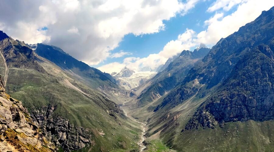
You can now see the Seven Sisters staring right at you from afar, if you can pull your gaze away from the chilly water swooshing over and all around the helpless stones as it crisscrosses the walkway. It’s understandable that you’d want to sit in silence and watch the grandeur in front of you as it unfolds, but you can be assured that things will only get better from this one. As the walk along this somewhat easy muddy trail gradually becomes a steep climb via tall grass. The path narrows, the slopes steepen, and the winds develop a fresh set of incisors. As you progress up the mountain, you’ll find yourself moving farther and farther away from civilization, listening to a variety of roaring winds and soothing bird chirps – even sometimes deafening silence with the whisper of fallen leaves crunching beneath your feet as you walk. You’ve entered the lovely forest, which is marked by tall ferns, higher shrubs, and the ground strewn with pine needles. It isn’t a challenging climb, but it does have an elasticity to it. It is not a difficult ascent, but it has a supple quality to it — it seems to go on forever because the brain has so much to analyze and store. You are now introduced to open regions with green mountains once you are well above the tree line. From this vantage point, you can see the entire valley beneath. Soak in the vistas, noises, and taste of the wind from this lovely point on the earth.

Hadimba Devi Temple:

The temple is said to be built on the place where Hindu god Hadimba meditated, it  was designed and built by Maharaja Bahadur Singh in 1553 CE . This connection links the location to the Mahabharata era. Hadimba, was born into a rakshasa (demon) household. Hidimba along with her family used to reside in the wilderness near Manali, according to folklore. Her brother Hidimb was killed by Bhim, one of the Pandavas, and eventually she married Bhim.   They had a son named Ghatotkachha, who fought for the Pandavas in the Mahabharata battle. Hidimba is revered as a divinity by the locals. This ancient temple in Manali is surrounded by a deep cedar forest, which is a pleasant surprise in such a touristic area.

Solang Valley:

Solang Valley gets its name from the words Solang  which means near a village and Nallah means water stream. This is a small valley right at the top of the Kullu Valley in Himachal Pradesh, India, famed for it’s own summer as well as winter sports facilities. Parachuting, paragliding, skating, horse riding and zorbing are the most popular sports.

Solang Valley is known for its large lawn slopes, which contribute to its popularity as a ski destination. A few ski academies and rental shops are located here, and they are only open during the winter months. Solang Valley, commonly known as the ‘Snow Valley,’ is at an average elevation of 2,560 metres above sea level, this brilliant valley is among Manali’s most stunning vistas.

Easy Access :

Traveling to the Himalayas from outside of India comes at a significant expense in terms of time and money going to and from the peak. The Friendship Peak climb begins in Manali, a well-known tourist location. Aside from the time spent on the hills, you will begin and end your trek in a location that is well-connected to every large city, reducing the amount of time spent travelling. What’s more, the route puts you off the grid for the entire week but reconnects you at just the appropriate times so you can show your dear ones the most gorgeous aspects of the path. Although there is no network on any of the campsites, there must be network on the rest of the property.

Pick up location

Dhundi

Drop location

Dhundi

Price Includes

  • Camping accomodation during trek on sharing basis
  • Camping essentials: Dome Tents, Kitchen tent, Toilet tent (traditional pit style), Sleeping bag, Harness & Carabineers
  • Breakfast, Lunch, Evening tea, Dinner during trek
  • Guide, Group Porter, Cook, Helper.
  • Portable Oxygen cylinder, Pulse oximeter, BP apparatus, Infrared thermometer & other staffs
  • Permits

Price Excludes

  • Accommodation in Manali
  • Transportation between Manali and Dhundi
  • Off loading of personal luggage
  • In an event of a trekker deciding on discontinuing the trek midway due to any circumstance/ evacuation, he/she will be escorted till the nearest road end from where the further expenses of transportation, hotel/ hospital and food shall be managed and borne by that trekker. In such unfortunate event the trekker won’t be eligible for the refund.
  • Personal trekking gears like clothings, trekking shoes, trekking poles, toiletry and other items mentioned later in things to carry section.
  • Any cost escalation (accommodation, food, transportation) due to unforeseen circumstances like landslides, roadblocks, bad weather, pandemic crisis, sudden government policies or regulations
  • Any expense arising out of itinerary will have to be borne by the Trekker
  • Gratuity/ Tip
  • If the the weather condition remains favourable throughout the trek and buffer day is not utilized henceforth the trekker completing the trek in 7 days, the cost of accomodation and fooding for the rest of the stay will be borne by the trekker.
  • If the buffer day is utilized then the trekkers have to make an extra payment for the buffer day.

Advisory

  • Always carry a valid original photo ID card with you.
  • Cellular connectivity is available till Dhundi and may not be available after that. There won't be any phone network available during the trek.
  • Trekking is an activity where there are more than 50% chances of facing uncertainty, as you see it’s mentioned “Tentative” itinerary. Weather conditions, wildlife movements, permission changes can often force the trek leader to change the itinerary, distance or place.
  • Throughout the trek, starting from the pick up to the drop, the final decision will be taken by the trek leader and all the trekkers will be expected to abide to the same.
  • All participants are expected to have a fitness level, stamina and the ability to sustain harsh environments.
  • Every trekker will have to undergo a temperature and other vitals check every day.
  • Do weigh your Gears post packing. It should not exceed the range of 8-10 kg – preferably on the lighter side.
  • The last reliable ATM is present at Dhundi
Booking terms
Confirmation policy
  • Email on booking@meandmountain.com or WhatsApp on +91-9051055011 the following details: Name of the participant(s), Name of the event, Date of the event, Email address (Note: This is not the Enrolment form) and proceed with the online payment either via the payment link shared via WhatsApp or the payment section on the website.
  • Mode of payment: only online
  • The participants will receive the Confirmation email and Ticket via email within 48 hours.
  • Ater the confirmation, you will need to send the dully filled, signed and scanned forms (Enrolment, Medical & Self-declaration) to booking@meandmountain.com, before commencement of the expedition.
  • The forms can be downloaded from the links below or ‘FORMS’ section in the home page.
  • It is mandatory for all the participants to submit all 3 forms before the expedition, in absence of which Me and Mountain shall have a full right to deny the entry of that participant to the particular expedition.
Cancellation policy
  • Cancellation done any time after the booking of the event shall be adjusted in any event later with ‘Me And Mountain Global Adventures Pvt Ltd’ only via Adjustment voucher. The Adjustment voucher will be valid for 1 year from the date of the event cancelled.
  • Refer the section on Cancellation/Refund Policy for the detail cancellation policy.
Discontinuation policy
  • In an event of a participant deciding on discontinuing the event mid-way due to any circumstance other than medical condition requiring emergency evacuation, he/she will require to do so by signing the ‘Discontinuation form’ after which he/she is set to go on own. In such situation the participant will neither be eligible for the Refund or the Adjustment voucher.
Reaching Basecamp

Our basecamp is Dhundi. You would need to hire a taxi to take you to Dhundi in the Solang Valley if you were staying in Manali. Driving from Manali to Palchan and turning left after passing the Solang Nallah bridge will lead you to Solang Valley. The major town of Solang will be your first stop, followed by the settlement of Dhundi.

In order to reach Dhundi you need to reach Manali first. The various ways to reach Manali are given below:-

By Air

The nearest airport to Manali is Kullu Manali Airport, which is located in Bhuntar, about 50 kilometres from the town of Manali. Direct domestic flights operate from Delhi and Chandigarh to the airport. Prepaid taxis are available outside the airport for transfers from Bhuntar to Manali’s main town. One of the closest airports to Manali is the Chandigarh International Airport. By cab, it just takes 6 to 9 hours to get from Chandigarh to Manali.

By Bus

Manali is well-connected to major tourist sites including as New Delhi, Shimla, Kullu, and Leh by a vast network of state-run and privately operated buses. Take a breath-taking trip through the town’s twisting hillside roadways. On the route, have a glimpse of the enthralling beauty of the mountain ranges, dazzling waterfalls, and lush green valleys. To guarantee a more pleasant ride in the steep terrain, use Volvo coaches over regular buses for the lengthy journey to Manali. Otherwise, the interconnected State Highways and National Highways are in excellent shape, ensuring a smooth and pleasant journey.

By Train

Joginder Nagar Railway Station is the closest railway station to Manali and connects to various major cities around the country. Ambala and Chandigarh are two alternative train stations from which to reach Manali. At a modest fee, one may access many kinds of transportation, including taxis and buses, from the railheads. Aside from that, the Kalka Railway Station, located at the foot of the Himalayas, connects Manali to important cities such as New Delhi, Amritsar, Jammu, Kolkata, Mumbai, Jaipur, Bhopal, Indore, Patna, Kanpur, Lucknow, Guwahati, Bangalore, Hyderabad, and Chennai.


Tentative itinerary
May change as per the local authority permission & availability of accommodation

Day 1Acclimatization day in Manali

After reaching Manali you will spend the first half of the day for becoming acquainted with the mountain air and each other. While the body acclimates, you are going to use this time to discuss the next events – timetable, what to anticipate, fundamental do’s and don’ts in the mountains, how to protect the sacredness of the environment, and other important topics. You can utilize the day by spending some time on discussing how to pack your bags for a successful ascent. This is accompanied by a demonstration of the same, which is followed by the installation of all necessary equipment. You have to spend the night in homestay (cost not included in package).

Day 2Manali to Dhundi via Solang Nalla and onward to Bakkarthatch

Altitude: 2,050m to 3,300m

Distance:  21 kms drive and 4.5 kms trek

Time Taken: 1 hour drive and 3 hours trek

After a magnificent breakfast, you need to board a car and proceed to the trek’s commencement location, a modest institution named Dhundi. This drive through Solang Nalla is a short distance from Solang Valley Road. The brief one-hour trip is an curious combination of lively towns and peaceful empty stretches until you arrive in another town with stores, hotels, and everything. The sight of inhabitants going about their business and the unusual stone-structured dwellings is appealing, providing you with a little look into the social and economic make-up of mountain living. The journey will take you through a wonderland of smooth mountain roads, with panoramic vistas of the Solang Valley in the background. If the weather is fine, you could get a glimpse of paragliders gliding about above the valley, with all its magnificent colours and brilliant blue skies, creating a picture-perfect scene.

The 4.5-kilometer trip begins in Dhundi at the latest by, with everyone carrying their own baggage. Horses transport rations, equipment, and tents. It’s a somewhat easy hike with a constant climb. We begin to witness magnificent sights of big mountains, such as the Seven Sisters, around an hour into the hike. This is followed by a half-hour rise.

There’s a brief break now as we reach some plains and lower regions. This, however, is just temporary. After around 10 minutes, we must start traversing large rocks and crossing rough trails in order to face another hard elevation. At the halfway point of the second hour, we arrive at a clearing where we pause for a while, taking in the grandeur of the surroundings while eating sandwiches and chocolates that had been prepared for us at the start of the walk.

From here on, it’s an uphill ascent through tall trees in deep mountain woods, with high ferns gently snaking their way over the tree line. While we’re still in the trees, we can hear the faint singing of typical Himalayan birds, which fades as we go closer to higher land. When we encounter small patches of steep descent, we appriciated the ascents even more.

By early evening, we should have arrived at our first campground, ‘Bakkarthatch’ – ‘Thatch’ meaning meadow. Right after we arrive, there is a demo/learning session on how to pitch tents, which will be useful since everyone pitches their own tents with the assistance of their tent mates.

We go up the flowery patches to a higher altitude for an acclimatisation walk once we’ve built the campsite. We return to the height of our campground for the night so that the body can adjust to what’s in store for it the next day. We will spend rest of the night in tents.


Day 3Bakarthatch to Advance Base Camp at Lady Leg

Altitude: 3,300m to 3,840m

Distance: 4 km trek

Duration: 3- 3.5 hours

The second day begins at a leisurely pace. We stretch our muscles a little after an early morning tea and breakfast in preparation for the climb ahead. After a little warm-up, we begin to work in the morning. Before we begin our hike, we must also close the campground, pack our tents, prepare our bags, and complete breakfast – we will need all the fuel we can get to reach our target for the day, Lady Leg.

Today will be slightly more difficult than yesterday. Despite the fact that the distance is roughly the same, the ascent is somewhat steep. The visual stimulus will keep you going all the way to Advance Base Camp! We stroll across the same meadows that we went through on our acclimatisation trek. The huge open meadows with a spread of green are visually appealing. Despite the fact that we are well above the tree line, the yellow wildflowers that cover the meadow floor offer warmth to the otherwise chilly air. For the entire three hours, the trek is a continual ascent. Sheep leaping up and down the mountain slope established some climbing objectives along the route.

By noon, you should have arrived at the advanced base camp. We pitch our tents here. If the weather permits, we’ll travel on to higher snow areas to be introduced to technical mountaineering equipment and practice basic ice craft techniques – abilities that will come in handy on summit day.

We will stay 2-3 nights at this camp, which is lush in green, teeming with sheep, shepherd dogs, and free-roaming horses, and serves as an amphitheatre for the highest peaks in both the Pir Panjal and Dhauladhar ranges. It also gives us our first glimpse of Friendship Peak in all its goodness! From here, the top begins to appear quite reachable, allowing us two full days to measure up our aim.

Day 4Load Ferry to Summit Camp

Altitude: 4,000m to 4,200m

Distance: 3 Kms

Time Taken: 2.5 Hours 

We will start the day with a steaming hot breakfast which is exactly what we need to be ready for our snowshoe adventure. It would come handy because today will be greatly challenging as compared to day 3. The route includes higher climbs and slicker ground. Walking in snow boots in a fresh landscape will take anywhere from 2-3 hours one way. Each trekker is responsible for carrying all of the equipment provided to them all the way to the summit camp.

As we get closer to Summit Camp, we leave the beautiful green meadows behind and reach a terrain riddled with loose rocks and heavy snow. Walking in snow boots is like relearning how to walk. It gradually becomes easier to walk as we travel further into the snow and become acclimated to the boots. The snow cover, on the other hand, might be rather thick, so keep an eye on your step. The gaze of the larger peaks – Hanuman Tibba, Priyadarshini, Indra Asan, Deo Tibba – guides us along the way.

We put up a tent and arrange all of our stuff in it once we get at the campground, which is determined by the availability of water. This serves two purposes: acclimatisation and reaching the tools halfway to the summit, so lowering part of the weight for some of the journey! If time and weather allow, we will do a complete guide on all things ice and mountain, from being introduced to technical equipment to learning how to utilise it and the value of collaboration on a mountain face.

We return to Lady Leg for the night, following the adage “Climb High, Sleep Low.” We will spend the chilly night in our tents here.

Day 5Onwards to Summit Camp

Altitude: 4,000m to 4,200 m

Distance: 3 Kms

Time Taken: 2.5 Hours

We pull up some of the tents in preparation for the Summit Push early tonight at Summit Camp. We trek up the stretch we climbed up yesterday one more time, carrying everything we need for the Summit push, including snacks and required gear. Today should be simpler because we’re acclimated to the new footwear and the path and distance are also known. We start the walk after a hot meal at approximately 2 p.m. since all we need to accomplish for the day is get to camp and relax our muscles.

Because we won’t be getting much sleep tonight, we’ll have plenty of time to sleep late in the morning. If the weather conditions are unfavourable, we will begin our Summit Push from Lady Leg. The purpose of erecting Summit Camp higher is to shorten the time it takes to reach the top on summit day.

Day 6Summit Day

Altitude: 5,289 m

Distance: 14-16 Kms

Time Taken: 12-14 Hours

And it all boils down to this – the grand finale! It goes without saying that today is by far the most tough and rewarding day of the climb. After a couple of hours of relaxation and allowing the body to adjust to the intense cold, we will head off for the Summit between 1 and 2 a.m.

Because there will be a lot of walking today, some snacks such as dried fruit packets, eggs, and sandwiches will be supplied. The early hours of the night are critical and need quick action – putting on the gear we have to begin with, remembering to carry all of our other gear, and notably not forgetting a head lamp, which will be quite useful during a night climb.

Prepare yourself for a tough 7-8 hour uphill ascent. The ascent becomes challenging after a reasonable first half hour, which primarily consists of walking on level snow with a few bumps here and there. Forty minutes into our ascent, it’s clear that this isn’t going to be an easy summit. During the winter, there are random ice boulders protruding out of the ice bed below, which needs frequent navigation and may rapidly lower your energy.

It’s considerably more difficult after the snow has melted and the rocks are visible. Navigating this rugged terrain with your snow boots and crampons is a whole different story. After 3 hours of navigating this terrain, you arrive at some gentle slopes in the mountain. These are gentler on the feet, but they are more steeper, necessitating the application of some skill and the ice axe at your disposal. We organise our ascent so that we get at the col between 05:30 and 06:00 AM to capture the stunning dawn that illuminates Manali and the Pir Panjal range.

We spend some time here admiring the vista and resting our bodies in preparation for what’s to come. We climb narrow ridges on a sharp inclination all the way up to the top from the col. It is a three-hour steep hike from the col to the mountain’s shoulder, followed by another 2.5-3 hours of ascent from the shoulder to the summit. We continue our descent after taking in the breathtaking scenery.

Descent can be difficult since the ice has begun to melt and has become more difficult to grasp. When we returned to Summit Camp, we packed up our tents and headed down to Lady Leg. The longer we remain in the snow, the more likely we are to become ill, thus it is critical to reduce height as rapidly as possible.

We spend the night in this comfortable place, giving our bodies the rest they need.

Day 7Reserved as a Buffer Day!

In the event of adverse weather or other obstacles, Day 7 is set aside for a second summit attempt. This will only be employed if unanticipated and unexpected conditions arise at the last minute, blocking the initial summit push. If the buffer day is utilized then the trekkers have to make an extra payment for the buffer day.

Day 8Back to Manali via Dhundi

Distance: 8-9 Kms trek and 21 kms drive

Time Taken: 4 hours and 1 hour

The final day of the walk is retracing our ways from Lady Leg to Bakkarthach to Dhundi. We begin early in order to reach a lower altitude as rapidly as feasible. The trek and driving should take you around two hours and get you to Manali by early evening.  If you are leaving Manali the same day, consider reserving late-night tickets to accommodate for any potential delays. If not, it is a good idea to reserve your lodging before you start the journey because there will be no network on the path. The journey comes to an end here.

Diet recommendation
  • Consume less spicy diet at least 7 days prior to the expedition
Fitness training
  • Cardiovascular training:
  • Stair Climbing
  • Push-Ups+
  • Squats
  • Crunches
  • Burpees
  • Jogging/ Interval Running
  • Free hand stretching
  • Walk daily at least 2-3km
Things to carry
Layering the upper body during trek
  • Layer-1: Body warmer
  • Layer-2: Dry-fit T-shirts
  • Layer-3: Fleece jacket
  • Layer-4: Down/ synthetic padded Jacket
  • Layer-5: Hard shell wind & waterproof jacket with hood
  • GlovesLightweight poly-liner gloves; Mid-weight soft shell gloves- water/wind resistant; Heavy-weight waterproof gloves with removable liner; Expedition weight mittens with fleece liner
Lower body during trek
  • Trekking trousers
  • Polyester/ active-wear socks
  • Trekking boots
Layering the upper body in the campsite
  • Layer-1: Body warmer
  • Layer-2: Dry-fit T-shirts
  • Layer-3: Sweater
  • Layer-4: Another layer of sweater
  • Layer-5: Fleece jacket
  • Layer-6: Down/ synthetic padded Jacket
  • Gloves
Layering the lower body in the campsite
  • Layer-1: Body warmer
  • Layer-2: Trekking trouser
  • Polyester/ active-wear socks
  • Woollen socks
Clothing for layering upper and lower body
  • 3 Dry-fit T-shirts
  • 2-3 pairs of Trek pants
  • 2 sets of Body warmers (polyester, avoid cotton)
  • 1 Fleece jacket
  • 1 Down/ synthetic padded Jacket to withstand sub-zero temperature
  • 2 Sweaters
  • 4-5 pairs of Socks meant for active-wear (blend of woollen & synthetic fabric) for wearing during the trek
  • 4-5 pairs of Woollen socks for wearing at the campsites
  • 2 pairs of well insulated Gloves
  • 1 wind + waterproof Jacket
  • Rain jacket
Headgear
  • Woollen cap, big enough to cover the ears along with the head
  • Woollen balaclava, covering the neck, mouth & nose
  • Sun cap with a back flap to protect the nape of the neck
Footwear
  • High-ankle boots (waterproof & with good insulation)
  • Slippers/floaters for campsite to be worn with woollen socks
  • Gumboots for the places where it’s necessary for the trekkers to cross shallow freezing cold water (in the absence of stable ice-sheet)
Gears
  • Rucksack: 60-70 litre with rain cover
  • Daypack: 20-30 litre with rain cover- apart from your personal items carry hand towel, extra set of cloth & socks
  • Sunglasses with UV protection
  • Quick dry towel
  • Trekking poles (preferably a pair)
  • Headlamp
  • Water Bottles: 1 Thermos & 1 regular bottle of 1 litre capacity
Other essential items
  • Toilet kit
  • 2 Tissue rolls
  • Sunscreen: SPF 40+
  • Personal medical kit
  • Snacks for personal consumption
  • Self-heating warming pouches (available online)/ hot water bag to keep yourself warm at night
  • Ladies: Menstrual hygiene products with zip lock bags to carry back waste for disposal. Menstrual cups are recommended over tampons/sanitary napkins.
Photos
Map