+91 9051055011 | +91 8969336262 info@meandmountain.com

Login

Sign Up

After creating an account, you'll be able to track your payment status, track the confirmation and you can also rate the tour after you finished the tour.
Username*
Password*
Confirm Password*
First Name*
Last Name*
Birth Date*
Email*
Phone*
Country*
* Creating an account means you're okay with our Terms of Service and Privacy Statement.
Please agree to all the terms and conditions before proceeding to the next step

Already a member?

Login

Everest Base Camp Trek

0
Moderate to Difficult
Booking Form
Enquiry Form
Full Name*
Email Address*
Travel Date*
People*
Your Enquiry*
* I agree with Terms of Service and Privacy Statement.
Please agree to all the terms and conditions before proceeding to the next step

Available dates:
12-05-2024

CUSTOMIZED:
Fees based on the final number of participants. Kindly contact +91-9051055011/ +91-8969336262 for the further detail before proceeding for the payment.

You will be directed to the secured payment gateway on clicking the button.

Proceed Booking

Proceed Booking

Save To Wish List

Adding item to wishlist requires an account

397

[trustindex no-registration=google]

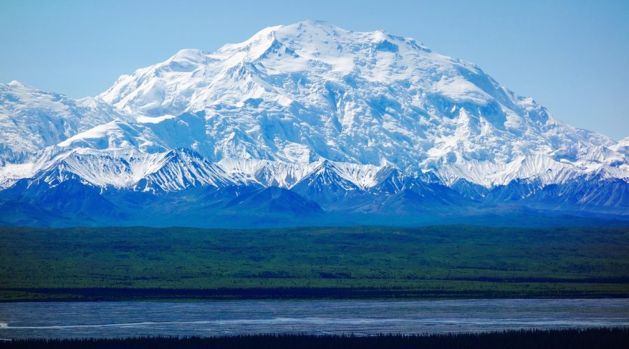
Glimpse of Everest Base Camp Trek:

Location: Nepal

Duration: EBC: 12 days/11 nights

                             EBC via Gokyo Ri: 16 days/15 nights

                             EBC  via Gokiyo Ri with 3 passes- 18 Days/ 17 Nights

Trek gradient: Moderate-difficult
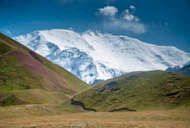
 Maximum Altitude: 5,644m (18,519ft) above sea level

 Pickup/ Drop Point: Kathmandu

Base camp: Phakding

Best Season: April to early June and September to mid-December

Temperature: Winter: 8.5˚/-2.8˚  Spring: 12˚/1.8˚  Autumn: 18˚/10˚

Customized fees:
Fees based on the final number of participants. Kindly contact +91-9051055011/ +91-8969336262 for the further detail before proceeding for the payment.

Overview of EBC (additional options- via Gokyo Ri, via Gokyo Ri with 3 passes) trek

Everest, a bucket-list destination for anyone with the love of mountaineering, it is the tallest of all mountains and is a childhood dream for many. Situated in the Khumbhu region of Nepal and towering at 8849 meters over the sea level, Everest or Sagarmatha is truly the pride of Nepal.

The trek to the South Base Camp of Mount Everest via 3 passes is a journey covering 130 kilometers over a period of 18 days. This trek will take you for an adventure of a lifetime through the khumbhu region along sweeping glaciers and mighty mountains. The journey will give you a perspective, from the breath-taking views of the towering Everest in the foreground, to the awe-inspiring panoramic view of the Himalayas from the Everest base camp. The Solu Khumbhu region boasts an incredible flora of rich lush green forest which many native animals and birds call home. Sure, the destination will make you feel on the top of the world, but it’s along the way that you will become one with the serenity of mother nature. Throughout the journey we will come across remote mountain monasteries and small villages of the Sherpa people, although the weather might get cold but you are bound to feel warm when they welcome you to their humble residence. This unique trek is best enjoyed in the Spring months of April to May and the Autumn months starting at late September to November. The trek to the base camp of the mightiest mountain is by no means a cake walk, it is sure your test you to your limits. Although while challenging, it is a well rewarding trek taking you to the top of the world through the arguably most serine and picturesque routes.    

Highlights of EBC Trek (additional options- via Gokyo Ri, via Gokyo Ri with 3 passes)
  • Kathmandu : Major tourist hub, Kathmandu, the capital of Nepal, is the gateway to Nepal Himalayas and stands at the elevation of 4,600 ft. While the city encountered a lot of damage and destruction during 2015 earthquake, it still carries its name as a fascinating place to explore. Various places like the famous Boudhanath temple,Thamel,Pashupatinath temple etc are worth visiting. Thamel, also known as Kathmandu’s trekking and tourism heartbeat is well known for its maze of narrow corridors sorrounded by prayer flags strung above. Festive restaurants, bookstores full of trekking maps and handmade crafts, cafes cover the place and are waiting to shelter you from the occasional afternoon thunderstorm that takes place. You can get every piece of trekking gear you may possibly hope for available for last-minute purchases before you begin your journey to the mountains.


  • Phakding : Just by closing your eyes, you could miss Phakding. It’s a small village that lies by the milky white DudhKosi river and is often the first stop on the route to Everest Base Camp. Yougonna be excited about the trek ahead, but don’t take this little spot granted because it is a photographer’s dream and comes withrustling flags, prayer wheels, and Mani stones, all colourful against the cloudy mollifying river that flows down the valley.


  • Namche Bazaar :“Gateway of the Everest Region”, Namche Bazaar is one of the major attraction of the Everest base camp trek. It is a delightful mountain town builds on a slope mountain with superb views of mountains like Thamserku, Kongde RI& other peaks in the background.You can shop here for souvenirs or even trek gear. Various facility like markets, standard lodges, restaurants, banks, ATM, shops, cafes, post office, cyber, and so on are available here. The local markets are a spectacle of trading since a lot of Tibetians cross the border to trade. This is a perfect place to buy genuine and best Tibetan artifacts. This popular touristic hub is situated at the altitude of 3,440 meters and it is also a great place for the altitude acclimatization for the trekkers.


  • Hillary Museum : It is situated in the world famous Namche Bazaar in the Everest region. This museum is open to all the trekkers who visited Everest region trek as well as expedition and research purpose. It is a primitive museum in the Everest region that is named after Sir Edmund Hillary. In this museum, you can explore traditional Sherpa lifestyles, culture, dresses, utensils, art and architecture, gears & equipment, and various other stuffs. This museum is very fascinating where you can view the past photographs collected from the local Sherpa community and Sherpa’s way of life in past. Mainly trekkers visit the Hillary museum on the acclimatization day at Namche Bazaar.


  • Tengboche : Tengboche is the one of the magnificent village of Everest region. It is such a charming spot for close views of the world’s beautiful mountain AmaDablam. Not only it offers view of AmaDablam but also it offers many other surrounding peaks whose views are simply amazing. It is also famous for the renowned oldest and biggest Buddhist monastery purifying spirit with the daily praying by Buddhist monks. Also, Tengboche is well-known for the Mani Rimdu Festival trekking, an important festival of local Sherpa people.


  • Dingboche:This summer settlement is the final acclimatisation point. A lot of  guided treks stays here for a full day, and those who got acclimatised well to the altitude cango to the nearby Nangkartshang Peak at 5,100m for spectacular views of Lhotse, Makaluand other peaks.


  • Labouche : It is a small hamlet with a couple of teahouses, Lobuche is 7km up the trail from Dingboche, and situated at the foot of the Khumbu Glacier. A number of treks travel from Lobuche to Base Camp in one push, before reaching back down to GorakShep for night.


  • Kumbhu Glacier & Ngozumpa Glacier :The Khumbu glacier and Ngozumpa glacier are the biggest and longest glaciers of Nepal respectively. The Khumbu glacier is about 12 kilometers long which lies between Mt. Everest and the Nuptse-Lhotse ridge. Also known as the world’s highest glacier, itconsists of large icefalls &begins from the Everest base camp. You can spectate this glacier from world’s highest base camp and also fromKalapatthar. On the other hand,Ngozumpa glaciers extends about 36 kilometers long andlay below Mt. Cho-Oyuand extending up to the Gokyo valley. In order to enjoy the outstanding view of Ngozumpa glaciers, you have to travel to the viewpoint of Gokyo RI.


  • Gokyo Lakes & GokyoRi : Gokyo Lake is a popular & wonderful adventure trekking route in the heartland of the Everest region. This trek is also known as Gokyo Valley trek or Everest Panorama trek, that is the alternative of Everest base camp. This lakesconsists of fiveother lakes and arefamous as world’s highest freshwater lakes. Gokyo RI is another superb view-point where we are rewarded with the sweeping panoramic view of world’s four highest peaks i.e. Mt. Everest, Lhotse, Makalu and Cho-Oyu with surrounding Everest panorama. Gokyo RI also offers the Everest’s five Gokyo lakes, and world’s longest glacier- Ngozumpa glacier.


  • Gorakshep & Kalapattar: GorakShep is used as an overnight stop before or after ascending to Base Camp. From here, an offshoot trek leads to Kala Patthar, at 5,545m. This is a tough hike and as high as most trekkers go, but once here, the reward is bucket-list views of Everest and surrounding peaks, and down over Base Camp. Kalapattharalso known asKalapathar, is one of the coolest view-points of Everest base camp trekking. It is the highest point of the Everest region trek and is located at the altitude of 5,545 meters. It is famous for its mind-blowing panoramic views of the world’s highest mountains. Trekker normally climb to Kalapatthar early morning or in the evening for viewing the sunrise and sunset over the Himalayas. You can praise the 360°panoramic views of world highest peaks above 8,000 meters like Mt. Everest, Nuptse,Lhotse, Makalu, Cho-Oyu, etc.


  • Basecamp : This rocky clearing, with the treacherous Khumbu Icefall just beyond, is where serious Everest summit attempts via the South Col route start. Three hourstrekking is required to reach here from GorakShep. It is a tent city during climbing seasons, but at other times of year it remains deserted. Major attraction is the world’s highest Mount Everest. It is also the extreme point for every trekker who treks to Everest base camp. Since there is a trait of altitude sickness and no any teahouse on base camp trekkers stay at the small village near base camp called Gorakshep. From here, we are blessed with the outstanding view of Mt. Everest, Lhotse, Nuptse, Pumori, majestic Khumbu glacier & icefalls, glacial rivers etc.
What to expect in various seasons of trek
  • Winter Trek:

(DecemberJanuary, and February)


Trekking to EBC during winter is not a mistake, but it’s certainly not so preffered season.

InJanuary there’s not alot of snow, so it’s possible to trek to Everest Base Camp then, but it is chilly. February and early March are cold, especially at night temperature falls to  -20°C or colder, but you are rewarded with clear skies providing good, and crystal clear views of Everest. Adding to that, the route will be less busy and the teahouses will be quieter, giving a sense of unadulterated adventure to the trek.


  • Spring Trek:.

(Late March and April)


 Late March and April are favorable months for trekking, with the weather warmer and the rhododendrons and other flowersblooming further down the journey. Days are beginning to stretch out to provide lots of daylight for exploring, too, with good visibility in the early mornings.


  • Autumn Trek:

(late September, October and Early November)


The autumn trekking season boost off in late September as the monsoon resides. Clear skies and fresh air churn this time of year. October to early November is the best time for trekking. Although the weather is cooler now at the base camp at about -10°C during the day but the days are dry and comfortable with uninterrupted views. Also adding to that is the fact that Nepal celebrates its most important festival of Dashain in late September and October.

Departure Location

Return Location

Kathmandu, Nepal

Kathmandu, Nepal

Price Includes

  • TransportationPick-up from and drop to Kathmandu airport, Domestic return flight between Kathmandu and Lukla
  • AccommodationAccommodation in trekker's hut/ hotel on sharing basis from Kathmandu to Kathmandu
  • FoodAll meals during the trek
  • Support staffProfessional mountain guide, Porters, Cook, Helper
  • PermitAll Permit fees
  • MedicalEmergency medical kit, Portable Oxygen cylinder, Pulse oximeter, BP apparatus, Infrared thermometer
  • Personal offloading of backpack

Price Excludes

  • InsuranceRecommended to get an insurance coverage which includes emergency medical, hospitaliation, repatriation expenses
  • Fooding in Kathmandu
  • Personal clothing and equipment gears like trekking poles, toiletry and other items mentioned later in things to carry section
  • Any cost escalation (accommodation, food, transportation) due to unforeseen circumstances like landslides, roadblocks, bad weather, pandemic crisis, sudden government policies or regulations
  • Any expense arising out of itinerary will have to be borne by the participant
  • In an event of a participant deciding on discontinuing the expedition mid-way due to any circumstance/ evacuation, he/she will be escorted till the nearest road end from where the further expenses of transportation, hotel/hospital and food shall be managed and borne by that participant. In such unfortunate event the participant won’t be eligible for the refund
  • Gratuity/ Tip
  • Mule for personal / rescue purpose will be additionally charged

Advisory

  • Always carry the original Photo ID card or passport with you during the trek
  • It is advisable to carry 2 extra passport photos
  • In an expedition there are more than 50% chances of facing uncertainty, hence you see it’s mentioned “Tentative” itinerary. Weather conditions, wildlife movements, permission changes can often force the leader to change the itinerary, distance or place
  • Throughout the expedition, starting from the pick up to the drop point, the final decision will be taken by leader and all the trekkers will be expected to abide to the same.
  • All participants are expected to have high level of fitness, stamina and the ability to sustain harsh environments.
  • Every participant will have to undergo a temperature and other vitals check-up every day.
  • Handy cash for Tip It is adviced to carry handy cash to be directly handed over to the local support staffs at the end of the trek
  • Do weigh your gears post packing. It should be on the lighter side for you to carry throughout the trek.
Booking terms
Confirmation policy
  • Email on booking@meandmountain.com or WhatsApp on +91-9051055011 the following details: Name of the participant(s), Name of the event, Date of the event, Email address (Note: This is not the Enrolment form) and proceed with the online payment either via the payment link shared via WhatsApp or the payment section on the website.
  • Mode of payment: only online
  • The participants will receive the Confirmation email and Ticket via email within 48 hours.
  • Ater the confirmation, you will need to send the dully filled, signed and scanned forms (Enrolment, Medical & Self-declaration) to booking@meandmountain.com, before commencement of the expedition.
  • The forms can be downloaded from the links below or ‘FORMS’ section in the home page.
  • It is mandatory for all the participants to submit all 3 forms before the expedition, in absence of which Me and Mountain shall have a full right to deny the entry of that participant to the particular expedition.
Cancellation policy
  • Cancellation done by 60 days before the commencement of the expedition: 100% of payment will be refunded.
  • Cancellation done between 45 days to 60 days before the commencement of the expedition: 50% of payment will be refunded.
  • In case of cancellation done within 45 days before the commencement of the expedition, the amount shall be adjusted in any of the events done later with ‘Me and Mountain’.
Discontinuation policy
  • In an event of a participant deciding on discontinuing the event mid-way due to any circumstance other than medical condition requiring emergency evacuation, he/she will require to do so by signing the ‘Discontinuation form’ after which he/she is set to go on own. In such situation the participant will neither be eligible for the Refund or the Adjustment voucher.
1. Tentative Itinerary- EBC trek
May change as per the local authority permission & availability of accommodation

Day 0Arrive in Kathmandu

Reach Kathmandu Airport from where we shall receive you and drop in the hotel. Check in the hotel and freshen up before heading to explore the magical city of kathmandu. Spend rest of the day visiting various famous places in Kathmandu and trying out lip smacking Nepali cuisine. Don’t miss on exploring Thamel.

Day 1 Kathmandu to Lukla via flight, Trek from Lukla to Phakding

  • Altitude: 1400m -2610m(phakding)  2860m(lukla)

Phakding is a stop on the Standard Everest base camp Trek and is roughly 85 miles that are 137 km northeast of Khatmandu. Now, as there is no motorable road to Phakding, we must take a flight to Lukla. It is a 30 minutes flight from Kathmandu to Lukla followed by a 4-hour trek to Phakding.

Day 2Phakding to Namche Bazaar

  • Altitude: 2610m-3440m

Namchi Bazaar acts as an assembly point for or expeditions to Everest. The 2nd day of the trek starts with the journey from the small village of Phakding to Namche Bazar, the main hub of Sagarmatha National Park. This is the most important and difficult part of the trek as we need to cover almost 3000 ft in just a day, but by the end of the day, we will be enjoying the night.

Day 3Namche Bazaar to Khumjung Everest view hotel then to Sangnasa or Losasa

  • Altitude: 3440m-3790m

On the day 3 of the Everest base camp trek we hike up from Namchi Bazar to the hotel Everest view, which is located 1444 feet above the village centre. The speciality of this hotel is that from here one can enjoy some of the most beautiful views of Everest while having some food and drink. 

Hiking to adjacent Sherpa settlements Khumjung may be done after a day or two of acclimatization in Namche. Hikes will be enjoyable since they will provide opportunities to meet lovely local people, feel the warmth of Sherpa culture, sample their cuisine, and observe the mountains from various perspectives.

Khunde and Khumjung, two traditional villages further up from Namche, are worth seeing. Beautiful panoramas can be seen on all sides of these two villages, which are separated by rocky fields and rock walls.

We trek from here to Sangnasa or Losasa for the night halt there.

Day 4Losasa to Pangboche

  • Altitude: 3790m-3860m
  • Today’s trek from Losasa to Pangboche will take you throught various forms of trails.
  • Trek along the beautiful trail, having a view of Dudh Koshi river, Mt.Thamserku, Mt.Kantega, Mt.Ama Dablam, Mt.Lohtse, Mt.Everest.
  • Tengboche monestary (Dawa Choling Gompa) is the largest monestary in the Kumbu region. Don’t miss to attend the daily prayer at 7am and 3:30pm.
  • The trail will also bring one of the famous view of Mt.Ama Dablam

Day 5Pangboche to Pheriche

  • The trek from Pangboche to Pheriche is along the view of Mt.Ama Dablam
  • The trail starts along the Imja river in the Imja valley.

Day 6Pheriche to Lobuche

  • You start today’s trail with a gradual ascend which leads to a bit steep climb.

  • You cross Thukla pass and reach the edge of Kumbu glacier and Everest memorial. Mt.Nuptse will welcome you as you approach Lobuche.

Day 7Lobuche to Gorakashep; Gorakshep to Everest Base Camp & back to Gorakshep

Today’s trek is to Gorakshep, the original basecamp for Mt. Everest expedition in 1950s. From Gorakshep you shall be trekking to Everest Base Camp, the destination of this trek.

The trail begins with moraine section along the Khumbu glacier. The climb is a mix of steep and gradual ascend. The trail becomes rocky as you approach Gorakshep. Then comes the view of Mt. Everest peeping behind Mt. Nuptse.

After some rest in Gorakshep, you shall trek to the trekker’s Everest Base Camp. The actual Everest Base Camp for the Mt. Everest expedition is farther and not accessible to the trekkers for EBC trek as it requires special permit. The trail is along the Khumbu glacier with a gradual ascend. The terrain becomes moraine type as you approach Everest Base Camp. On reaching the Everest Base Camp, spend some time celebrating your summit and then trek back to Gorakshep for the night stay.

Day 8Gorakshep to Kalapatthar & back to Pheriche

Today’s trail is the most awaited one whwn you will catch a sight of the mighty Mt. Everest, the tallest peak of the Earth, from the closest proximity on the trail.

Because of the structure of Mt.Everest, the summit of Mt.Everest is actually not visible from the trekker’s Everest Base Camp and Kalapathar is the point from where you get the unobstructed view of Mt. Everest.

The trek to Kalapathar from Gorakshep is a short (2km one way; 3-4 hr) but steep one, making it one of the most difficult segment in the entire trek.

Trek down from Gorakshep to ‘the Beach’, an ancient lake bed, from where you begin the ascend to Kalapathar. You can see Gorakshep village, Khumbu glacier and Mt. Ama Dablam behind you as you gain altitude. The trail becomes less steep as you traverse the eastern side of Kalapathar. Then the trail becomes steep again till you reach the summit ridge. After crossing a small section of the boulder zone, you reach a view point, where several prayer flags will be fluttering along with the chilly wind.

After spending sometime at Kalapathar, start the descend to Gorakshep and then to Pheriche via the same route from where you trekked up. Gorakshep to Pheriche is 15 km which takes approximately 6 hr. You will come across an intersection on the trail back from where a path leads to Gokyo Ri. Keep trekking on the trail on the left towards Pheriche. Cross the moraine wall of Khumbu glacier and trek down to Thukla pass. After crossing the Everest Memorial, trek down towards the river. After Thukla, you have to descend for Pheriche.So take the path going down hill. The path going above leads to Dingboche.

Look out for these peak from Kalapathar:

  • Close up view of Mt. Everest (8,848m)
  • Mt. Pumori (7,161m)
  • Mt. Lhotse (8,516m)
  • Mt. Nuptse (7,561m)
  • Mt. Amadablam (6,812m)
  • Mt. Changtse (7,543m ) – Tibetan mountain
  • Mt. Lingtren (6,749m)
  • Mt. Lobuche East (6,119m)
  • Mt. Cholatse (6,400m)

Day 9 Pheriche to Pangboche

Trekking down from Pheriche to Pangboche is via the same trail you took while trekking up to the Everest Base Camp. You will be trekking acros  the river and then up to the valley to trek along the valley. Today’s trek is comparatively short (5 km) giving you an ample of time to relax in Pheriche. 

Day 10Pangboche to Namche

Today you keep trekking (10km) downhill along the valley and cross villages- Deboche and Tengboche. The downhill trail from Tengboche to Namche is steep and zig-zag, across a beautiful suspension bridge. After a small section of a gradual ascend the trail becomes easier leading to Namche.

Spend your evening exploring Namche which is famous for its trade fair. 

Day 11Namche to Lukla

Today is the last day of the Everest Base Camp trek when you shall trek back to Lukla via Phakding. The trail is gradual with a few ascends and descends. The trail is across the waterfalls, lush green forests, river with valley and suspension bridges. Today’s trail is 19 km and takes 7-8 hr in average.

Day 12Flight from Lukla to Kathmandu

  • Altitude: 2860m- 1400m

On day 16th, we return from Lulka to Kathmandu, and finally, with our flight back, we bid goodbyes to this place and smiled with memories we just made.

2. Tentative Itinerary- EBC via Gokyo Ri
May change as per the local authority permission & availability of accommodation

Day 0Arrive in Kathmandu

Reach Kathmandu Airport from where we shall receive you and drop in the hotel. Check in the hotel and freshen up before heading to explore the magical city of kathmandu. Spend rest of the day visiting various famous places in Kathmandu and trying out lip smacking Nepali cuisine. Don’t miss on exploring Thamel.

Day 1 Kathmandu to Lukla via flight, Trek from Lukla to Phakding

  • Altitude: 1400m -2610m(phakding)  2860m(lukla)

Phakding is a stop on the Standard Everest base camp Trek and is roughly 85 miles that are 137 km northeast of Khatmandu. Now, as there is no motorable road to Phakding, we must take a flight to Lukla. It is a 30 minutes flight from Kathmandu to Lukla followed by a 4-hour trek to Phakding.

Day 2Phakding to Namche Bazaar

  • Altitude: 2610m-3440m

Namchi Bazaar acts as an assembly point for or expeditions to Everest. The 2nd day of the trek starts with the journey from the small village of Phakding to Namche Bazar, the main hub of Sagarmatha National Park. This is the most important and difficult part of the trek as we need to cover almost 3000 ft in just a day, but by the end of the day, we will be enjoying the night.

Day 3Acclimatization in Namche Bazaar

  • Altitude: 3440m-3790m

Day 3 of the Everest base camp trek is often known as acclimatization day in Namchi Bazar. Like most other people, we hike up to the hotel Everest view, which is located 1444 feet above the village centre. The speciality of this hotel is that from here one can enjoy some of the most beautiful views of Everest while having some food and drink. Now there is a particular reason why it is known as acclimatization day, most people out here is not accustomed of being 10,000 to 20,000 feet above sea level so so they body might act accordingly to prevent this altitude sickness it is common that accumulation begins around 11500-foot mark. As Namchi Bazar is just below that elevation, a lot of travellers spend a couple of nights in the village to get the body better prepared for the rest of the journey.

Hiking to adjacent Sherpa settlements like Khunde and Khumjung may be done after a day or two of acclimatization in Namche. Hikes will be enjoyable since they will provide opportunities to meet lovely local people, feel the warmth of Sherpa culture, sample their cuisine, and observe the mountains from various perspectives.

Khunde and Khumjung, two traditional villages further up from Namche, are worth seeing. Beautiful panoramas can be seen on all sides of these two villages, which are separated by rocky fields and rock walls.

Day 4Namche to Dole

  • Altitude: 3440m-4055m
  • We will be walking from Namche market to Dole on our fourth day. Dole is around 4055 metres above sea level. The journey may take anything from 5:30 to 5:47 hours. The trail was amazingly well maintained, with fitted flagstones making a good bit of the surface, and nice steps space out at a comfortable distance.
  • Not much further down we came to a Stupa that was dedicated to Tenzing Norgay, the Sherpa who was with Edmund Hillary on the first successful climb of Everest. Soon after, we came around another bend and got our first glimpse of Cho Oyu, the 6th highest peak in the world. This would become a constant companion for the next few days as we followed the valley northward towards Gokkyo, and one of those things that really makes you feel like you are some place special.
  • After about five hours of slow but steady climbing, we finally arrived at the village of Dole.
  •  

Day 5Dole to Machhetmo

  • Altitude: 3,985 m – 4,410 m
  • The journey from Dole to Machhermo is rather simple. It is essentially a traverse that is slightly uphill and acquires a net elevation of 1,200 feet; for most people, this is a half-day trek that allows for some rest and acclimatisation. The panorama, though, is always becoming better; above you, Cho Oyu, one of the 8,000-meter peaks and the fifth-highest mountain in the world at 26,864 feet, begins to loom.
  • Machhermo, where we’ll be spending the evening, isn’t much on its own, like Dole. It is located in a little cove, yet a stunning snow-capped peak rises just above it. Both towns are mainly Sherpa summer farming and pasture towns that have been transformed into rest spots for trekkers. These slopes will be lush and flower-filled in the summer and monsoon, with yaks grazing there. Their bleakness serves as a reminder of our progress thus far and the beautiful rewards that lie above.
  •  

Day 6Machhermo to Gokyo to Gokyo Ri

  • Altitude: 4450m to 4780m

    After a quick ascent to leave Machhermo, you start a lengthy, steady ascent across open terrain. The yak traffic in the summer is mostly to blame for the trail’s numerous braids in this area. As you near the mouth of the first Gokyo Lake, the canyon grows smaller and the landscape drier as the route climbs higher and becomes more rugged.

    The first of five Gokyo Lakes, which will still be partially frozen in March and April, will be seen after you reach the top of the hill.

    The first lake you come across is by far the smallest, yet it frequently appears to be a haven for golden Brahminy ducks. They are quite a sight among an incredible vista: a wide valley with the enormous Cho Oyu at its top, a huge glacier looming above, and the settlement of Gokyo just above the third lake a short distance away. You should be able to make out Gokyo Ri, one of the area’s best vistas, as a brownish-colored rocky hill in the centre of the picture with a route leading up it.

    Typically, we go trek back to Gokyo in time for lunch, allowing us to spend the afternoon taking rest, exploring the town, and taking a walk to one of the other lakes later.

Day 7Gokyo Ri then back to Thangnak

  • The distance to Gokyo Ri from the Gokyo is just 2,000 feet. But keep in mind that a few days ago, we were somewhere below 11,000 feet. We will start early in the day because our speed will unavoidably be slower than it has been that so far.


    The climb isn’t very difficult, but reaching the top while being covered with prayer flags is one of those experiences that hikers dream of. There are many of the world’s tallest peaks all around you, including four of the 14 summits that are higher than 8,000 metres, including Everest, which is the highest at 29,029 feet, Lhotse, Makalu, and Cho Oyu.

    After this exciting event, we return to Gokyo for some downtime, lunch, and packing. We’ll take a little hike in the afternoon to get a head start on the journey the next day.

     If we are headed over the Cho La pass to Everest Base Camp, we will actually cross the Nzogumpa Glacier, then travel around the side of the valley to reach the village of Thagnag (16,486’). Here we will the spend the night after a long yet an amazing day.

Day 8Thangnak to Phorche or Pangboche

  • Altitude: 4690m to 3995m
  • Today we will trek to Pangboche. We will descend downwards from 4690m to 3995m and we will witness peaks like Tabeche, Cholatse. The trail is undulated and it will be a long walk.
  • After reaching Pangboche, we will have our dinner here and spend the rest of the night.

Day 9Pangboche to Pheriche

  • Altitude: 3995m to 4280n

    Today we will trek from Pangboche to Pheriche. It’s a quite easy walk. We follow the Ijma river which flows directly east of the village. We will spend the day here to continue our acclimatization

Day 10Pheriche to Labuche

  • Altitude: 4280m to 4930m
  • Today we will ascend to the village of Labuche, which is tucked below Labuche peak. Our trek will take us past the memorials for climbers. There are dozens of large rock stupas and strings of prayer flags at the top of Thokla pass. Along the way we will leave the last of the large vegetation and enter into the alpine zone and our trail would be covered with snow from here. We will spend the night here.

Day 11Labuche to Gorakshep EBC

  • Altitude: 4910m -5140m
  • Lobuche is 4.5 kilometres, or 2.8 miles, from Gorakshep. The journey from Lobuche to Gorakshep took us 2 hours, including an hour for lunch. The route is level and simple to follow at first. Later, we’ll go to Base Camp, which is at an elevation of 5364 metres. We’ll gain 454 metres today, but we’ll sleep at 5140 metres, so it’ll be a gain of 230 metres.

Day 12Gorakshep to Kalapatthar then back to Pheriche or Dingboche

  • Altitude: 5140 m – 4390 m
  • Although it is possible to return to Lobuche directly from GorakShep, the climb to Kala Patthar that is a tiny rocky mountain with views of Everest and the Khumbu Glacier is also a well worth a final bit of uphill climb before the long trek down to Pheriche or Dingboche

Day 13Dingboche to Sangnasa

  • Altitude:4390m to 3640m
  • We will descend further from Dingboche and travel towards Pangboche.The trail is covered with pine trees and we will cross Tenboche and travel few kilometre to reach Sangnasa. It is located near Namche Bazaar. We will spend the day here.

Day 14Sangnasa to Monjo or Phakding

  • Altitude: 3640m to 2623m
  • Today we will start our journey from Sangnasa and travel down to Namche bazar. We will travel further towards Monjo crossing Jorsale and finally we will reach Phakding.

Day 15Phakding to Lukla

  • Altitude: 2623m -2860m
  • Now finally, on day 16, we will get back to Lukla from Phakding.

Day 16Lukla to Kathmandu via flight

  • Altitude: 2860m- 1400m

On day 16th, we return from Lulka to Kathmandu, and finally, with our flight back, we bid goodbyes to this place and smiled with memories we just made.

3. Tentative Itinerary- EBC via Gokyo Ri with 3 passes
May change as per the local authority permission & availability of accommodation

Day 0Arrive in Kathmandu

Reach Kathmandu Airport from where we shall receive you and drop in the hotel. Check in the hotel and freshen up before heading to explore the magical city of kathmandu. Spend rest of the day visiting various famous places in Kathmandu and trying out lip smacking Nepali cuisine. Don’t miss on exploring Thamel.

Day 1 Kathmandu to Lukla via flight, Trek from Lukla to Phakding

  • Altitude: 1400m -2610m(phakding)  2860m(lukla)

Phakding is a stop on the Standard Everest base camp Trek and is roughly 85 miles that are 137 km northeast of Khatmandu. Now, as there is no motorable road to Phakding, we must take a flight to Lukla. It is a 30 minutes flight from Kathmandu to Lukla followed by a 4-hour trek to Phakding.

Day 2Phakding to Namche Bazaar

  • Altitude: 2610m-3440m

Namchi Bazaar acts as an assembly point for or expeditions to Everest. The 2nd day of the trek starts with the journey from the small village of Phakding to Namche Bazar, the main hub of Sagarmatha National Park. This is the most important and difficult part of the trek as we need to cover almost 3000 ft in just a day, but by the end of the day, we will be enjoying the night.

Day 3Acclimatization in Namche Bazaar

  • Altitude: 3440m-3790m

Day 3 of the Everest base camp trek is often known as acclimatization day in Namchi Bazar. Like most other people, we hike up to the hotel Everest view, which is located 1444 feet above the village centre. The speciality of this hotel is that from here one can enjoy some of the most beautiful views of Everest while having some food and drink. Now there is a particular reason why it is known as acclimatization day, most people out here is not accustomed of being 10,000 to 20,000 feet above sea level so so they body might act accordingly to prevent this altitude sickness it is common that accumulation begins around 11500-foot mark. As Namchi Bazar is just below that elevation, a lot of travellers spend a couple of nights in the village to get the body better prepared for the rest of the journey.

Hiking to adjacent Sherpa settlements like Khunde and Khumjung may be done after a day or two of acclimatization in Namche. Hikes will be enjoyable since they will provide opportunities to meet lovely local people, feel the warmth of Sherpa culture, sample their cuisine, and observe the mountains from various perspectives.

Khunde and Khumjung, two traditional villages further up from Namche, are worth seeing. Beautiful panoramas can be seen on all sides of these two villages, which are separated by rocky fields and rock walls.

Day 4Namche Bazaar to Pangboche

  • Altitude: 3440m-3985m

We will be walking from Namche market to Pengboche on our fourth day. Tengboche is around 3800 metres above sea level. The journey may take anything from 5 to 5.30 hours. We had views of the valley and the locations we’d hiked, thanks to a steep start. We dropped to Fungi Tanga, then climbed steeply back up to Tengboche, back down to DiBoche, and up to Pangboche, the Khumbu Valley’s oldest monastery.

Day 5Pangboche to Dingboche

  • Altitude: 3,985 m – 4,410 m

We will arrive at Pangboche late. Today is Day 5 of our trip, and we’re headed to Dingboche. It is located at the height of 4350 metres above sea level and will take around 3 and a half hours to complete. Somare is the first settlement we will encounter on this section of the trip, and it is also the only village in between. So, if you’re in need of a break, this is the place to go.

Day 6Acclimatization in Dingboche

  • Altitude:  4410 meters

Here in Dingboche, is a day of relaxation and acclimatization. We will, however, go on a trek to help us acclimate more, and we will gain around 1,000 feet, that would bring us to a new high point on the trip at 15,500 feet.

Day 7Dingbiche to chhukung

  • Altitude: 4,410 meters –  4,730 meters.

While most visitors to the Everest region choice for the conventional out-and-back trek to Everest Base Camp, you may alternatively go from Chukhung to Everest Base Camp via the Kongma La Pass. On day 7 of the EBC trip, instead of going from Dingboche to Lobuche, you can walk to Chukhung on the opposite side of the valley. Adding Chukhung (sometimes written Chhukhung) to your schedule will allow you to visit a part of the world that most people never see.

Not only will you be able to cross the Kongma La Pass into Lobuche, but you will also be able to go on walks to Island Peak Base Camp and up ChukhungRi.

Day 8Chhukung to labuche (via Kongma La pass)

  • Altitude: 4730 m- 5535 m(hight point here)

The Kongma La Pass is one of the more demanding hiking alternatives in the Everest area for everyday trekkers. With that challenge, though, comes its beauty. The views from the summit of Kongma La are, without a doubt, some of the greatest in the region.

Day 9Lobuche to Gorakshep then to EBC & back to Gorakshep

  • Altitude: 4910m -5140m

Lobuche is 4.5 kilometres, or 2.8 miles, from Gorakshep. The journey from Lobuche to Gorakshep will take us 2 hours, including an hour for lunch. The route is level and simple to follow at first. Later, we’ll go to Base Camp, which is at an elevation of 5364 metres. We shall descend back to Gorakshep and rest in the Gorakshep. We’ll gain 454 metres today, but we’ll sleep at 5140 metres, so it’ll be a gain of 230 metres.

Day 10Gorakshep to Kala Patthar then to Zongla

  • Altitude: 5140 m – 5,643 m

Although it is possible to return to Lobuche directly from Gorakshep, the climb to Kala Patthar which is a tiny rocky mountain with views of Everest and the Khumbu Glacier is also a well worth a final bit of uphill climb before the long trek down to Lukla.

Day 11Zongla to Thangnaak (via Cho La pass)

  • Altitude: 5643m- 4700 m

We’ll get up early today to cross the difficult Cho La Pass, and we’ll follow the path as it ascends gradually down the valley and steepens as we reach the pass. The Cho La Pass is mostly coated in blue ice, giving hikers a chilly experience.

Day 12Thangnaak to Gokyo Ri

  • Altitude: 4700 m- 4750m

It takes roughly 5 hours to travel from Thangnak to Gokyo.

The Ngozumba glacier, which is harsh, dry, and cold, is a 4-5 hour journey to the stunning Gokyo lakes. The day is brief and restful in the Gokyo Lakeside, which is surrounded by mountains.

Day 13Acclimatization at Gokyo Ri

  • Altitude: 5357 m

Day 14 is a rest day. Just after Namche Bazaar, we leave the main track on this alternate route to Everest Base Camp via GokyoRi. This made us feel as though we’ve entered another world in less than ten minutes.

Day 14Gokyo to Lungden (via Renzo La pass)

  • Altitude: 5357 m – 5360 m

The Gokyo-Renzo La Pass Trek takes you to the other spectacular sides of Everest within the high hidden Khumbu valley, a picturesque site where visitors may see the world’s four highest peaks in one glimpse. All trekkers will enjoy Gokyo valley and Renzo La pass trekking, as it is one of the most beautiful sites in the Mid-Eastern Himalaya, located within the Khumbu and Everest regions.The towering snow-capped summits of Mt. Cho-Oyu reflect on its seething green glacial lakes, creating stunning scenery and photographs of the high Gokyo valley.

Day 15Lungden to Namche Bazaar

  • Altitude: 5360m – 3440 m

We began our journey on day 16 from Lungden to Namche Bazaar (3850 M)

From Lungden to Thami, the walk is primarily downhill. Thami is Tenzing Norgay’s village, and the monastery there is worth seeing.

Day 16Namche Bazaar to Phakding or Ghat

  • Altitude: 3440m – 2610m

From Namche, we again headed back to Phakding.There are three enormous stones near the small village of Ghat with astonishingly clear Buddhist prayer texts cut into their sides.

Day 17Phakding to Lukla

  • Altitude: 2610m -2860m

Now finally, on day 18, we will get back to Lukla and rest there to take return flight for Kathmandu the next day.

Day 18Lukla to Kathmandu via flight

  • Altitude: 2860m- 1400m

On day 18th, we returned from Lulka to Kathmandu, and finally, with our flight back, we bid goodbyes to this place and smiled with memories we just made.

Diet recommendation
  • Consume less spicy diet at least 7 days prior to the expedition
Things to carry
Layering the upper body during trek
  • Layer-1: Body warmer
  • Layer-2: Dry-fit T-shirts
  • Layer-3: Fleece jacket
  • Layer-4: Down/ synthetic padded Jacket
  • Gloves
Layering the lower body during trek
  • Trekking trousers
  • Polyester/ active-wear socks
  • Trekking boots
Layering the upper body in the campsite
  • Layer-1: Body warmer
  • Layer-2: Dry-fit T-shirts
  • Layer-3: Sweater
  • Layer-4: Fleece jacket
  • Layer-5: Down/ synthetic padded Jacket
  • Gloves
Layering the lower body in the campsite
  • Layer-1: Body warmer
  • Layer-2: Trekking trouser
  • Polyester/ active-wear socks
  • Woollen socks
Clothing for layering upper and lower body
  • 3 Dry-fit T-shirts
  • 2-3 pairs of Trek pants
  • 2 sets of Body warmers (polyester, avoid cotton)
  • 1 Fleece jacket
  • 1 Down/ synthetic padded Jacket to withstand sub-zero temperature
  • 2 Sweaters
  • 4-5 pairs of Socks meant for active-wear (blend of woollen & synthetic fabric) for wearing during the trek
  • 2-3 pairs of Woollen socks for wearing at the campsites
  • 1 pairs of well insulated Gloves
  • 1 wind + waterproof Jacket
  • Rain jacket
Headgear
  • Woollen cap, big enough to coverthe ears along with the head
  • Balaclava, covering the neck, mouth & nose
  • Sun cap with a back flap to protect the nape of the neck
Footwear
  • High-ankle boots (waterproof & with good insulation)
  • Slippers/floaters for campsite to be worn with woollen socks
Gears
  • Rucksack: 60-70 litre with rain cover
  • Daypack: 20-30 litre with rain cover to carry water, snacks and personal items
  • Sunglasses with UV protection
  • Quick dry towel
  • Trekking poles (preferably a pair)
  • Headlamp with extra batteries
  • Water Bottles: 1 Thermos & 1 regular bottle of 1 litre capacity
Other essential items
  • Toilet kit
  • 2 Tissue rolls
  • Sunscreen: SPF 40+
  • Personal medical kit
  • Snacks for personal consumption
  • Self-heating warming pouches (available online)/ hot water bag to keep yourself warm at night
  • Ladies: Menstrual hygiene products with zip lock bags to carry back waste for disposal. Menstrual cups are recommended over tampons /sanitary napkins.
Photos